Friday, July 31, 2015

Camp Sherman & Scout Lake

Last day in Oregon! To play that is, I have almost 300 miles of Oregon to drive through tomorrow!

It was going to be another hot one so Dad and I decided to head out early to do a bike ride that was suggested to us by the Ranger at the Ranger Station yesterday. We drove up to Camp Sherman, which is a summer/"resort" community up along the Metolis River in the Deschutes National Forest. There are a few lodges, a few commercial campgrounds, some summer homes and a bunch of National Forest Service campgrounds, as well as a neat little store.

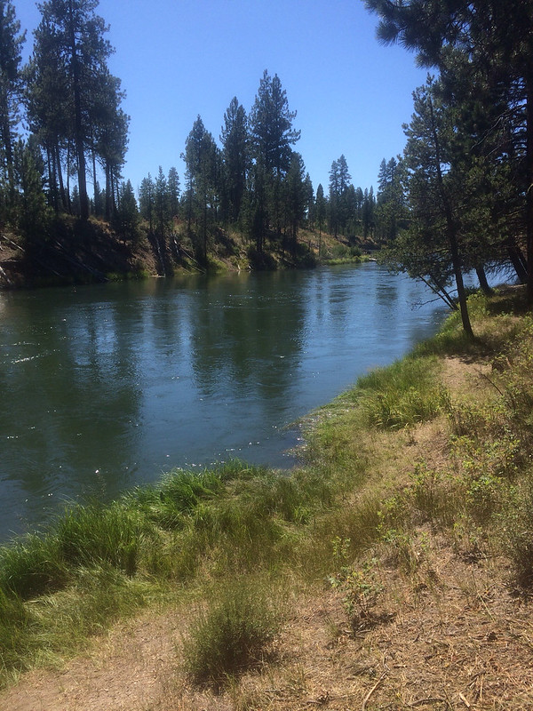
We parked at the Camp Sherman store and rode out bikes up Forest Service Road 14, unlike most Forest Service Roads this one was paved and made for a nice bike ride. It was rolling, which I like because it's not all up or down, but there was more downhill on the way out. We rode all the way out to Lower Bridge Campground and back - about 15.5 miles round trip. On the way back we avoided the big hill by taking another paved Forest Service Road that went down by the river.

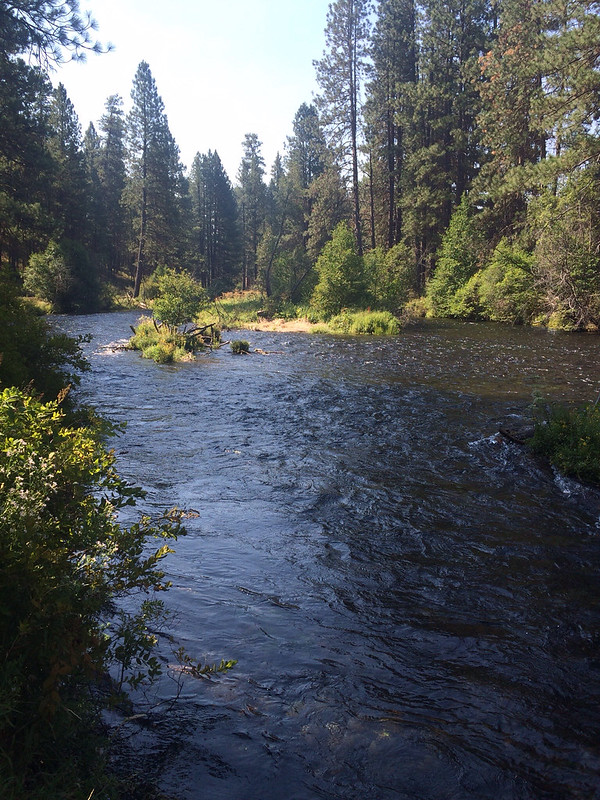
After our ride we checked out the Camp Sherman Store! I was very impressed by the quality of products they carried, it was a lot like an organic grocery store! We also went to the head of the Metolis River, it appears to come right from under the mountain!

We came back to Sisters for lunch. We stopped at the campground and got Mom and changed out our gear - put the bikes away and got swimsuits and other things needed to relax by the lake for the afternoon. We had lunch at the Fir Street Market, a natural and organic grocery store/cafe in Sisters. The food was fabulous! I had a salad and it was all very fresh and crisp. After lunch we had to go back to BJs Ice Cream for some more Oregon Trail ice cream.

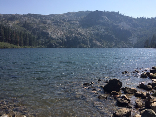
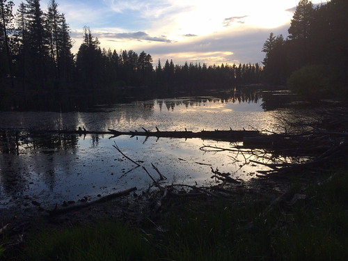
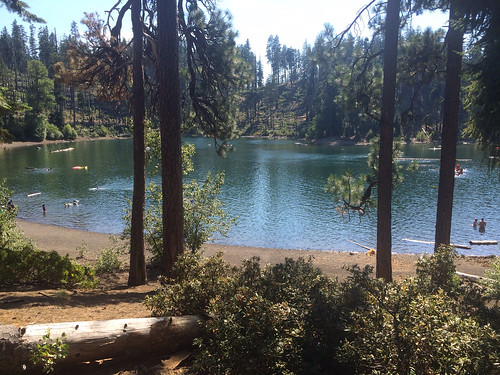
Sufficiently fed we headed back out US20 into the mountains to Suttle Lake. Suttle Lake is a huge lake with a resort, at least three campgrounds and a boat launch, but best as we could tell, no day use area for lounging and swimming. There were folks who had set up in the boat launch area but there was little shade. There was another lake up the road, Scout Lake so we headed up there. This lake turned out to be perfect! It was much smaller, but there was plenty of shade on the shoreline and there were lots of swimmers!

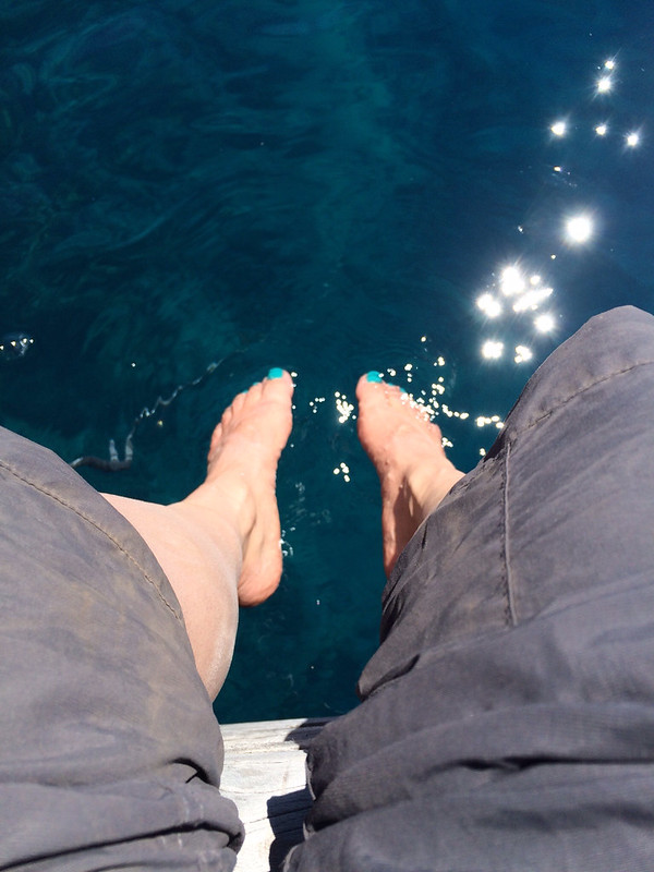
We stayed our claim under a tree and I quickly got in the water! I love swimming and my favorite place to swim is in a lake! Especially one like Scout Lake where there is no set swim area and you can just go wherever! There were a lot of people in the lake, many with floats and kayaks and stand up paddle boards. There were also a lot of dead trees floating in the water, which was fun because you could sit on them and I even "paddled" one around the lake for awhile, but it made it hard to really swim because of fear of running into something! I swam all the way across and back - the lake is bigger than it looks and floated around on a log for awhile! A family of ducks even swam over and shared my log for awhile! It was a wonderful spot to spend a very hot afternoon.


On our way out we discovered the Suttle Lake Day Use area, it was by the lodge and it wasn't nearly as nice as the Scout Lake Day Use area so it ended up working out the best.

We got back to Sisters around 5:30 and went to a neat Mexican resteraunt for dinner and then came back to the campground to run generators and clean up - I'd pulled out all kinds of stuff today and hadn't even cleaned up breakfast because we wanted to get going before it got hot.

Around 7:45 Dad and I set out on our bikes to go back to the Snow-Cap for blackberry shakes! It's only about a 1/2 mile from the campground but it was a nice ride, the sun was setting and it was getting cooler!


Thursday, July 30, 2015

The Grand Tour

It stayed warm most of the night, slowly dipping into the 40s, after it being so cold the last few nights I had prepared for a cold night - long pjs, extra blanket, closed the windows at the first chill, this meant I was hot almost all night! It was nice to wake up to warmer temps and be able to enjoy breakfast at my picnic table rather than huddled in my sleeping bag inside!

Our first stop of the day was Sisters Bakery. We'd walked by there yesterday and Mom wanted to try one of their doughnuts. I had a taste of Mom's doughnut and Dad's energy bar thing, both were good! We talked to someone who's been to bakeries all over Oregon and he says Sisters Bakery is one of the best! After our snack we went to the National Forest Service Ranger Station to find out about hikes and bike rides for tomorrow.

Next it was off to Smith Rock State Park. Smith Rock is a big deal fir rock climbers, it's one of the premier spots in the country for rock climbing. It's a huge volcanic rock uprising, it's really neat to look at, but it's all exposed with no shade at all. And it's out in the desert and it was over 100* today. They had some trails that looked interesting, but it was so hot and sunny and uncomfortable to enjoy them. Dad and I did hike down into the canyon and along the Crooked River - it was maybe 2 miles, probably closer to 1.5 - it was nice but so hot!


On the map of Smith Rock we saw The Cove Palisades State Park. We'd never heard of it and it was close so we went to check it out. This park was right below a big lake where they have dammed up the Deschutes River and the Crooked River. Two lakes had been formed with a giant butte in the middle. We sat by Crooked River lake for a little while, it was cool in the shade. There was a swimming area but it wasn't really appealing for swimming - lots of plant debris and stuff floating. Both lakes were down in canyons with high volcanic rock sides. The lakes were nice but the rest of the landscape was hot and desolate.

We noticed on the map that we could get back to Sisters a back way from this park so we set out. Turns out the back way was all desolate, isolated, dirt road. No houses, no towns, just dust, scrub pine and sage. The high desert at its finest. And hottest.

We got back to Sisters at 3:30 and decided it was time for a treat. We stopped at one of two ice cream places in town. All homemade ice cream with no junk! The Oregon Trail with chocolate ice cream, blackberry swirl and hazelnuts was very good!

After ice cream we headed up McKenzie Pass. I was expecting a normal mountain pass where you get to the top and you can see all the other mountains, maybe there's a meadow up there or maybe just trees. Well, not here. This mountain pass was a lava flow. Of course it was. All of Oregon is volcanic! It was actually pretty neat - it was lava rock as far as they eye could see! We also had views of the Sisters, Mt. Washington, Three Fingered Jack and Mt. Jefferson, Mt. Hood was out there too but hard to see (we'd seen Mt. Hood earlier, bringing the trip full circle as we'd started there back at the beginning of the month.). At the pass there was a 1/2 mile interpretive trail, paved with signs about all the volcanic features and an observation tower.


Next we set out to find the other pass - the signs said we were on a scenic road that included two passes, I can't remember the name of the other one. When the road was headed steeply downhill we figured the other pass wasn't on this road so we asked the GPS how to get back to Sisters and it took us another back way - lead us out to 126 and back to US 20. This took us down the other side of the mountains which is not in the desert! It rains here! These woods were lush and green and cool! The total opposite of the terrain on the Sisters side of the mountain. We found several hikes that we could come back and do tomorrow as well as a lake to swim in!

By this time it was 7:00 and we needed to get back to run our generators and eat dinner. After dinner we decided to go check out the other ice cream place in town - I don't remember it's name but it's a drive-in type place right on the edge of town. I had an amazing blackberry milkshake! Real blackberries! Yum!


Wednesday, July 29, 2015

Biking LaPine State Park

Today ended up being a transition day, we didn't do anything too exciting, but we got stuff done that needed to happen.

It wasn't quite as cold overnight, but it was colder than I would have expected for July! It took the sun a long time to get up over the trees where it could warm my RV. I ended up having breakfast in bed again! I was just about ready when Dad came over, he wanted to ride some of the trails in the park before we left.

As you all know, Dad and I are not mountain bikers and the times we've attempted to ride on trails has never ended well. All the trails through LaPine State Park appeared to be wide flat packed sand, and there were no signs saying "no biking" and there were tire tracks on all the trails we'd seen. So, we decided to try it.


For the most part it was fine - wide and packed, flat, and easy to ride. There were spots where the sand was softer and that was hard. We did a loop with the Deschutes River Trail to the Fall Creek Trail. The Fall Creek trail was narrower and had more obstacles - little things like roots, rocks, soft sand, curves, bushes, up hills, downhills, things you'd never notice walking but that conspire against you when you are biking! I had to get off and walk a lot because I'd lose my momentum to a soft pile of sand or the downhill was just too twisty and steep. When we came back around and I saw an RV through thr trees I knew we were back in the campground so I bailed on the trail,and hot back out to the road. Dad was really far ahead of me so I couldn't tell him. Once on pavement I was zooming along and I got back to our sites at exactly the same time he did.

The scenery was not that interesting. Pretty much just Ponderosa Pine. If we were hiking it would have been really boring, and hot. At least biking made it more challenging and interesting. It was about 8 miles so would have taken us all day to walk, it only took about 2 hours to ride.

After our bike ride we went into Bend and got some fresh veggies at a farm stand, did the rest of the shopping at Fred Meyer and Dad went to fetch the mail.

After the shopping we drove the 20 miles to Sisters and we will be here through Saturday, when I head back to the east coast. On the way to Sisters we had great views of the Three Sisters Mountains, Mt. Bachelor, and I think Mt. Hood. After dinner we walked into the town of Sisters. It's a cute little town, but at 8:00pm everything was shut down.

We are now in the high desert area of Oregon. It was in the 90s during the day today (when I left the Fred Meyers the van said it was 106*! That was on the hot pavement in the sun, it quickly fell to about 95) and tonight it's going down into the 40s!


Tuesday, July 28, 2015

Kayaking on the Deschutes River

It was another cold night at Mazama Village! It was 45* inside when I woke up! We didn't have anywhere to be this morning so I didn't even get dressed right away, I made coffee and ate breakfast in my long underwear snuggled in my sleeping bag. After yesterday's experience of it being 10* colder outside vs inside I didn't go out or open the door until I was ready to go see when Mom and Dad were ready to go, and when I did go out I discovered that it was very nice outside! The sun had come up and warmed everything up, except the inside of my RV!

It was about 10 when we rolled out, heading for Bend, or near-ish to Bend as it turns out. I stopped to dump and to get some last pictures of the lake and Wizard Island. The rest of the drive was unremarkable and soon I was in La Pine. La Pine is a small town about 20 miles south of Bend and there was La Pind State Park was in one of the campground books so we decided to see if they had sites, and they did, for tonight only.

The park is nice, but it's not as scenic. It's mostly just pine forest and sand. It was very sunny and warm this afternoon and hiking wasn't appealing. The park is home to Oregon's largest Ponderosa Pine so we had to check that out. It was underwhelming. The Deschutes River flows right through the park and it looked kayak-able so we scouted a good put-in (trail right by our campsite lead to River access) and take out spot (by the big tree) and came back to get the boat ready!

I carried the Sea Eagle inflatable kayak under the bed all last summer and we didn't use it, and I've had it this whole trip and we haven't used it, so it was good to get it out! We inflated it and noticed air escaping from the right gunwale. We secured the valve and figured the problem was solved.

We had to walk about a 1/4 mile down a sandy trail to the water. The river access spot wasn't the best put in - the water looked to be moving fast and it was deep. Dad had decided to bring a rope and tie the boat to a tree and then let it loose when we were in. Turns out the rope was a bigger problem! We both got in easily and then the rope got caught on the tree! We left the rope and came back to get it!

As we paddled along we realized that the current that looked strong from shore, wasn't really that strong. And the scenery was very repetitive. It was nice, but once you'd seen a 1/4 mile of it, you'd seen it all. Also, it appeared that the right gunwale was losing air, but we weren't sure. The boat was definitely listing to that side.

There was a side channel that looped back to the main channel and we paddled down that. It either had no currently or we were paddling upriver, because we were both paddling a hard as we could and getting no where. I guess we'd underestimated how strong the current really was! As we came around the bend heading back to the main channel it looked like it was all grass. It appeared that our side trip was a dead end and we'd have to turn around, or portage. But luckily there was a narrow channel in the grass, just wide enough for a kayak.

Almost as soon as we were out in the main channel again we were at the Big Tree, which was our take out point. We easily got the boat to the shore and hopped out. The water was cold! Not as cold as Crater Lake, but cold! Dad texted Mom to come get us and we hauled the boat up the hill to the parking lot. It was obvious as we walked up that the right gunwale had lost a lot of air. Dad had is kayak straps so rather than deflate the boat in the parking lot we decided to put it on top and bring it back inflated so we could investigate why it was leaking.

After Dad and I both looked at it and determined that it may not be a problem we can fix. It's complicated to explain here. I like having the Sea Eagle, for days like this, but the fact that I never used it last year and we've used it only once this year means that if I can't come up with a fix, I'm probably not going to replace it. Inflatable kayaks aren't cheap. This was one of the cheaper ones. I may have a lot of extra space under the bed...especially because we decided that my custom made leveling blocks are a waste of space because they don't remedy the van being out of level so Dad took them since they are nicer than his blocks and we had a campfire burning his old leveling blocks! So, no big bag with the kayak, no big leveling blocks means all I have is a chair and my bike pump!


Monday, July 27, 2015

Wizard Island

Today was the day for our boat ride around the lake with a three hour side trip to Wizard Island! To get the boat we had to travel back up to the rim, then drive about halfway around the lake to the Cleetwood Trail Head, then walk 1.1 mile downhill, 770 feet downhill, to get to the boat dock. There is a lot of construction along the west rim of the drive and they said to allow an extra 40 mins to get through it.

It got really cold last night! I was sleeping in my long undwear and got in my sleeping bag and closed the windows! The coldest morning was also the earliest morning since Dad and I decided we needed to leave by 7 to ensure that we had enough time to make it to Cleetwood dock to get the boat at 9:45! The other cold mornings I've been able to get up a bit later after the sun has come up!

The temperature in the RV this morning was 46*, I didn't turn the heat on because I hate the smell of the burning dust and the propane furnace almost always sets off the CO/LP detector! I just got dressed and crawled back into my sleeping bag and ate breakfast in bed...like a real camper! LOL! When Dad picked me up the temperature in the Jeep was 37*, and it fell to 34* on the way up to the rim! BRRR! I was impressed that it was 10 degrees warmer inside versus outside though!

We didn't run into any traffic from the construction, we went through before they started, and arrived at the parking area by 7:30. We needed to be there by 8:45. So we were a bit early, and it was too cold to walk down to the dock early, so we drove a little ways down the road then went and sat in the parking lot. We saw lots of people going down to the dock in shorts and t-shirts and kind of thought they were crazy. We figured it was going to be super cold out on the water with the wind and yesterday was so cold all day. We had all the cold weather gear!

Turns out we were the ones that were over prepared! As soon as the sun got up good it was hot! We were taking off layers of fleece and stuffing them in our backpacks and trading fleece hats for sun hats. The air was cool, but the sun was hot and intense! And today was a glorious clear day with no wind! This was great for watching the colors in the lake! And the boat ride was calm - the afternoon wind makes the boat rides rough sometimes.

The boats are small, they hold 37 people I think, and we had a Ranger with us who narrated the whole tour! A lot of the information she had was similar to the movie yesterday but it helped to be seeing the things she was talking about! We learned more about volcanoes than I ever wanted to know!


After about an hour on the boat we arrived at Wizard Island! Wizard Island is a cinder cone volcano that formed after Mt. Mazama erupted, it emerged after the lake was formed! It's named Wizard Island because it looks like a Wizard Hat! (Of course almost all cinder cone volcanoes look like wizard hats!) on Wizard Island there are two trails - one to the summit and one to Fumerole Bay. If you hike to the summit you can walk all the way around the rim and even down into the crater. You can also fish (the fish don't belong in the lake, they encourage the catching of as many as you can and removing them from the lake), swim (yes, swim, it's allowed, but the water is cold) Dad and I hiked up to the summit as soon as we got there, the views were amazing! The lake was at least 9 different shades of blue! I walked all the way around the rim, Dad walked down into the crater.


I really wanted to swim in Crater Lake, but the cold water temperature (about 55*) combined with the cool air temperature (60s during the day, but remember that hot sun...) and the cold morning made me rethink my plans. After our hike we had about 30 minutes before he boat was coming back so I went down to the dock and stuck my feet in! The water was very cold! My feet never really got used to it, but it did feel good!


Because the water in Crater Lake is so pure - it's all snowmelt and rainwater - it's incredibly clear!

After our time on Wizard Island we got back on the boat and continued our tour of the lake. We went past all the features we'd seen yesterday - Pumice Castle, the Phantom Ship, only now we were down on the water! We had many chances to look at the water and see how crystal clear it is and to examine it's color.

It was 3:00 when we returned to the boat dock, ready for the 1.1 mile uphill hike - re-gaining the 700 feet we lost thus morning! There were lots of people at the Cleetwood Dock area, some were swimming, many were sunbathing on the rocks. Cleetwood Cove is the only place where you can access the water. I still kinda wanted to swim, but I'd have to walk up the hill wet and I didn't want to do that. Once back at the parking lot we saw the traffic backup from the construction, it didn't take long to get through it though, and soon we were back at the campground ready for an early dinner!


Sunday, July 26, 2015

Crater Lake National Park

Woke up to a very chilly morning! I kept my long underwear on until 10! It was very refreshing! I actually used my sleeping bag this morning! And, it wasn't as cold as it will be tomorrow morning! Its forecast to go down into the 30s tonight!

The first thing I needed to do this morning was buy tickets for the Wizard Island cruise for tomorrow. I couldn't buy them until 9:45 this morning, my plan was to be first in line at the kiosk in the gift shop. I decided I needed to be there by 9, which is very late for me, I was ready to go by 8:20, and that was after I'd slept in, and had a leisurely breakfast with my kindle.

Mom and Dad were staying at a casino about 20 miles away and coming in this morning to get a "first come, first served" site. I realized that I could probably pay for their site before they got here. This campground operates differently from any other campground I've been in. You either make a reservation (50% of the sites are reservable) or you show up at the kiosk. You pay your money and tell them what type of site you need - tent or RV and how long your RV is. They give you a card with your departure date and a color, you can then go and pick any site of that color (the colors tell how big the sites are, I'm yellow (even though I could fit anywhere!) and Mom and Dad are red), you can even move sites if a better one opens up! You just put your card on the site post. This makes it very easy to extend your stay, just go pay again and the site is yours! So anyway this morning I went up and bought Mom and Dad a site before they got here. It ended up getting very confused because Mom and Dad came in while I was at the boat ticket kiosk and the guy I'd talked to about thrust reservation was on a coffee break! We did eventually get it worked out, and I paid for my extra day so I could stay three nights!

I got to the boat ride kiosk about 8:40. A whole hour before I could make my purchase. I'd brought my Kindle so I stood there and read. About 9:20 a family came up and got in line behind me. A few other people came up and bought tickets for today. Then finally at 9:45, I clicked through the screen and made my purchase!

Camping spots secured and boat ride tickets purchased, we were now free to explore the park. After an early lunch we set out for the rim. I decided Mom and Dad needed to see the lake first, before going to the visitor center or starting the drive, so we went directly to the rim. The lake is just awesome! Pictures will never do it justice, you all just have to come.


After checking out the lake at Rim Village we went back down to the visitor center to watch the movie. At Lassen we wished we'd watched the movie first, here's probably wasn't as important, but the movie was good and we learned about how Mt. Mazama erupted then collapsed and formed Crater Lake. After the visitor center we headed east on the Rim Drive and began our journey around the lake.

One of the amazing things about Crater Lake is it's amazing blue color. The water is so pure and clear that when the sun hits it the color is just unbelieveable! And the color varies depending on the water depth and the way the light hits it. Unfortunately for us, the clouds started rolling in just as we began driving around. This meant that the lake was "lake" colored not the bluer than blue color. It was also quite cold and windy all day. But, the lake is still amazing and I took a ton of pictures anyway.

After our drive around the lakers headed back to the campground for generator time and dinner. It's already very chilly and it promises to be a cold night. It's still very cloudy, I hope all that clears up for tomorrow's boat ride!


Saturday, July 25, 2015

Lava Beds National Monument

I'd never heard of Lava Beds National Monument until I was studying the map a few weeks ago. It was only a wee bit off route and I wanted to go, mostly to get my passport stamped and "check it off". It was only an hour down there from Klamath Falls so we went down there this morning, turns out it was really interesting!
One of the really cool things at Lava Beds is they have tons of Lava Tube caves that you can explore on your own! They have trails through them and you can bring your own caving gear (or just a flashlight) and check them out! Most parks with caves you have to go on a Ranger tour, so this was something special.
When we arrived we were asked if we'd been in any other caves east of the Rockies and were shown a map, if we'd been in a cave in a shaded state we had to stop at the Visitor Center to be "decontaminated". White Nose Syndrome is a disease that is killing bats and it's spores travel on humans who wear the same shoes or bring the same clothing into caves. Since we'd been to Wind Cave, we had to get cleaned before we could go in the caves! Once at the visitor center we surrendered our shoes and our phones - we think those are the only things we had on today that we'd had on at Wind Cave! The ranger wiped them both down with Lysol-type wipes and returned them to us cleaner than than they'd ever been!
Once we cleaned we headed for the easiest cave, Mushpot. It's right by the visitor center and it's lighted. It was a lot like the cave tours I've done before, only it was volcanic so looked different inside. After Mushpot we drove out the cave loop to Sentinel Cave. Sentinel Cave is one of the only ones you can do as a loop. We walked the road down to Lower Sentinel Cave then walked about a 1/4 mile on a trail to the cave entrance, then walked up the cave! It was soooo cool! The path in the cave was a jumble of rocks and it was dark! No natural light at al, just the light from my headlamp! The trail was easy to follow, there weren't any branches or anything to confuse us, just a straight walk to the other side. In a few places there were steps and some railing around a big pit, but otherwise it was volcanic rocks and dark!
The cave walk didn't take long, it was probably a mile tops. So when we got done we went over to Schonchin Butte, which is the only cinder cone you can climb. It's 1.4 miles round trip. At the top you could see everything! The landscape out there is so arid and dry, lots of sagebrush, volcanic rock and dust. Beyond Lava Beds it's all farmland! It looks at bit like Kansas.
After our hike to Schonchin Butte it was time to head back to Klamath Falls so I could drive out to Crater Lake. The other night we were trying to work out the details of going to Crater Lake and I managed to get a reservation to camp 2 nights but when I went to make Mom and Dad's reservation they were full. They are staying at a casino tonight and will come in tomorrow!
It was about an hour to drive to Crater Lake and when I got here I got my site, figured out where to go to buy my boat tickets for tomorrow, and drove to the rim looking for cell phone signal to text Mom and Dad. There is not cell signal to be had, I couldn't get a connection anywhere! BUT, the lake is amazing!!!!! (Pictures in tomorrow's post!) We are planning to drive around tomorrow so I didn't spend a lot of time at the rim!
After I came back to the campground I did some cooking - made dinner and a salad to eat for lunch then next few days - that was fun because I've never really cooked in the RV! Clean up was the hardest part! After dinner I walked around the campground, continuing my quest for signal and finding none. I walked over to the camp store, where I met a family from Fairfax! She is a secretary at an FCPS High School! Small world!

Friday, July 24, 2015

Bunny Flats & OC&E Rail-Trail

This morning we pulled out of the KOA and parked the RVs in downtown Mt. Shasta so Dad and I could hike from Bunny Flat to Horse Camp. The town of Mt. Shasta is interesting! Very hippy, crunchy, and earth-y! We went to an organic grocery store yesterday and everyone in the store had on tie dye! There are also a lot of PCT thru-hikers. I think it would be a fun town to spend more time in at some point.
Dad and I drove back to where we'd been yesterday, most of the way up the scenic drive up mountain and started hiking! The trail is the same trail that the climbers use to get to the summit! There aren't many people climbing now because the snow is melted and it's best to climb over ice and snow, the scree and rocks aren't safe. The first mile of the hike was mostly level, the second mile was where we gained elevation!
As we were driving up the mountain we got behind the fire truck - same one that had been there yesterday, the driver let us pass but the fire crew got to Bunny Flat the same time we did! We knew they were heading to the tree that was burning! They had to gear up, but they quickly caught up to us on the trail. We got to hike with them for a little while and they were really fun to talk with! All young men, but they seemed to enjoy hearing of our adventures! Soon however the hill got steeper and Dad and I slowed down, no match for 20-something fire fighters who are acclimated to the 7,000 ft elevation!
We did run into the fire crew at Horse Camp before they headed off to finish putting out the tree! Horse Camp has a caretakers cabin and is sort of a base camp for folks planning to summit Mt. Shasta. It's almost 2 miles from the road, and very easy to get to. Inside the caretakers cabin there is a lot if interesting reading material about the mountain and the routes to the top. We weren't going to attempt to summit so we turned around and went back to the car.

Back in town we grabbed lunch at a Mexican place, then headed to Klamath Falls, OR. Before I left I wanted to get fuel, it was only $2.99 and in California I could pump it myself! I pulled into a Chevron station and there was a big bump which caused me to scrape the low points on both the driver side and passenger side! I examined everything while I was pumping and didn't see any damage, however, as I was getting on I-5 I heard something dragging under the van! I was already on the highway though and couldn't pull over! I got off at the next exit and found a place to park to check it out. The sewer cap had come off, but was still attached! I quickly got it back on and was headed for Klamath Falls!
We are staying at Wal-Mart and it just so happens that there is a rail trail only a few blocks away! Soon after we got here Dad and I loaded up the bikes to check it out. It didn't look too promising, the trailhead was in an industrial zone and the only folks around looked a little creepy. We forged ahead, figuring we could turn around if it wasn't fun. The trail was paved, wide and smooth! We were flying along and soon we were out of the residential section and it was open farmland! Farms surrounded by mountains! It looked a little like Kansas met up with Wyoming, very flat and very dry mountains, but it was nice! It was exposed, no shade, but the air wasn't too hot! It ended up being a nice ride! We went about 6 miles to where the trail turns to dirt. The trip back wasn't as nice...on the way out we'd had a tailwind pushing us a long, now we were riding into the wind and it was harder!

When we got back to Wal-Mart Mom had dinner almost ready and we both got showers since it was warm then. It going down to 45 tonight so it will be very cold in the morning! After dinner Mom and I went to Wal-Mart to get a few things we needed. There are some kids hanging out in the parking lot and a very large Prevost bus on one side and a Hippie painted school bus on the other! Interesting night in Klamath Falls, OR.

Thursday, July 23, 2015

Mt. Shasta

Today we explored the Mt. Shasta area there's not as much to do here, but there are a lot of trails to hike, including The Pacfic Crest Trail (PCT), which is long distance trail, similar to the Appalachian Trail, that runs from Mexico to Canada and it passes right by the town of Mt. Shasta.

This morning Dad and I went to Castle Crags State Park. There area many forest fires in the area and the smoke was causing it to be very hazy, which meant the views weren't as good, but we went up to vista point and then hiked to a small cascade. On the way back we hiked a small, maybe 0.25 tenth a of a mile, section of the PCT.

View of Castle Crags rocks.

View of Mt. Shasta through the smoky haze.

After lunch we got Mom and went out to drive the Mt. Shasta scenic drive. It was about 15 miles up the mountain through the Trinity-Shasta National Forest, to about 7,000 ft, so about halfway to the top. We had great views of the mountain and we would have had great views of the surrounding mountains if it wasn't for the haze.

At the Bunny Flats trailhead there was a NFS "information" trailer and the man who was staffing it, don't think he was a ranger, he might have been a volunteer, told us that there was a tree that had been struck by lightining on Tuesday (the same storm we saw building when we hiked to Paradise Meadow dumped a whole bunch of rain on the Mt. Shasta area) and was on fire and the NFS was sparing no resource in putting out the lone tree that was on fire. We saw the helicopter flying with its bucket of water! The information man told us they were likely getting the water from Castle Lake.

We continued the last three miles up the road to the end and had great views of the Old Ski Bowls, a smoky view of the mountains to the west, including Castle Crags where Dad and I were this morning.

Mt. Shasta from Old Ski Bowls

Looking west from Old Ski Bowls on Mt. Shasta.

Next we drove out to Castle Lake! We saw a sign to it and remembered that's where our friend in the information trailer had told us they were getting the water to put out the burning tree! The helicopter was done ferrying water, but the lake was very nice! Would have been a good place to kayak if we'd had the boat!

After dinner we went to the local laundromat! It was "wash the sheets" day, always a pain, but it has been two weeks and last night I discovered a ton of sand in my bed! You all know how I feel about sand, and sand in my bed is not ok. When I pulled the sheets off the bed I discovered about a tablespoon of sand in a pile on one corner of the mattress pad! I don't normally take the mattress pad off so I considered borrowing Mom and Dad's dyson stick and vacuuming it. I also considered pulling it off and washing it, but I'd washed a similar mattress pad and it melted the backing. I finally decided to take it off and shake it out. I had to stand on to of the picnic table (it's solid stone!) so the mattress pad didn't touch the ground and get more debris on it. I'm sure the other campers were wondering what I was doing and why. My only regret is that I didn't think to sing Taylor Swift's "Shake it off" while I was on the table with the mattress pad! Here's hoping all the sand is out!


Wednesday, July 22, 2015

Hikes in Lassen

Dad really wanted to hike up to the top of Lassen Peak. I did not. It was all exposed, rocky, sandy, path, and it was 2.5 miles up with 2000 ft of elevation change. It didn't look like fun to me at all. But, Dad was really excited about it, so he was going to go. I decided I'd hike to a waterfall that was a three mile round trip from the campground. This was a first, we've never split up and hiked our own hikes before. I kinda liked it. I like hiking with Dad and travel with the, however after several weeks of constant togetherness a little apart time is good and it's hard to get because we all want to do the same things.

I enjoyed my hike out to Mill Creek Falls. The trail was rolling with great views of the surrounding mountains and forested. I ran into one person, and that was on my way back. The falls were pretty cool and they were at the head of deep canyon! I enjoyed walking in the cool of the morning!

View along the trail

Mill Creek Falls

When I got back I got a shower and met Mom over at the visitor center. We checked out the gift shop, watched the very informative movie, and checked out the exhibits in the Visitor Center. We learned a lot about volcanos and that Lassen is one of the only places on earth that has all four types: cylinder cone, plug dome, composite, and shield.

After we finished at the visitor center we still had about an hour until we expected Dad back so we decided to drive up to Sulfer Works since she didn't get to go to Bumpass Hell yesterday and you could see all the same stuff right at Sulfer Works and it was right up the road. We weren't very far up the road when we saw Dad coming down! He'd finished early!

We checked out Sulfer Works and Dad got cleaned up, then we looked at his pictures from the hike! He thought it was fabulous and really had a good time. The pictures were great, but I didn't regret my decision not to hike it!

Then we returned to the visitor center to get lunch in the cafe and let Dad see the movie (Mom and I watched it again!), then we got on the road heading for the Mt. Shasta area.

We stopped at Camping World near Redding and it got to be dinner time by the time we were arriving at the Mt. Shasta KOA. The section of I-5 through the mountains was very stressful, it was all up and down and twisty and the truckers were not nice. Normally I like driving with the truckers, but here they all seemed very aggressive and no matter what I did I was in their way. I just wanted to get to the campground! When I finally pulled in I just wanted to get my site, plug in and eat dinner. Registration went fast because we'd made a reservation and I had a pull through site! What I hadn't anticipated was the "Welcoming Committee"! I was working on hooking up when a lady appeared around the side of my RV telling me how much she loved it and would I show her the inside. I agreed and soon my RV was surrounded by about 10 of her closest friends and relatives all who apparently were wanting to buy a van like mine. One couple was from North Carolina and they were traveling in a Leisure Travel van. The original gal who came over first, was traveling in a Coach House van - she was from CA. Almost as soon as they'd come up, thru dispersed and I was able to continue hooking up and got dinner!


Tuesday, July 21, 2015

Bumpass Hell

Today we explored Lassen! It's a very cool place!

We started at Chaos Crags overlook, which is where Mom had cell signal yesterday. Mom and Dad had Verizon signal, but I'm on AT&T and I had very little signal. Once Mom and Dad had finished their internet/phone things we headed down the road.

The first place we came to was Devestation Area. This is the area that was destroyed when Lassen Peak erupted in 1915! 100 years ago! There was a 1/2 mile interpretive trail there but we decided not to walk it. We headed on to one of the hikes that I had in my Best Easy Day Hikes: Redding, CA book. The first hike we came to was Kings Falls, but the sign said that the overlook was closed for renovation and we weren't sure we could see anything and we've seen lots of waterfalls, so we moved on.

Lassen Peak from The Devestated Area parking lot

The next hike in the book was to Paradise Meadow. We missed the parking area because it was labeled something else, and there wasn't enough parking anyway. The next spot to pull off was Lassen Peak trail head parking. This lot was huge! And, I had cell signal there! We left the RVs Nd Dad and I took the Jeep back to the trailhead. The hike in the book got to Paradise Meadow a different way, but our way worked! We got to walk the downhill portion first, the up on the return, which I like better! While we were hiking a big storm was brewing to our north. We heard some thunder and the clouds continued to build, but it never got close. The meadow was very nice, although the promised wildflowers were as abundant as we'd hoped, I'm guessing that's another casualty of the drought.

Paradise Meadow

We returned to RVs and noticed that Bumpass Hell, the area where you can see the hydrothermal features (mudpots, furmoroles, steam vents), was right down the road. This is *the* hike in the park and we'd heard how fabulous it was from several people. Mom was going to hike with us and she started, but it's not an easy hike - goes uphill and down and is rough - and it was too much for her so she turned back. Dad and pressed on. The trail leading up to the crater that contains all the volcano stuff was really nice. It had great views of the other mountains, all of which are volcanos! Bumpass Hell itself wasn't too nice. It was stinky - sulfer, like a hot springs, and not very attractive. It was like a mini Yellowstone, only Yellowstone is more accessible and has more interesting geothermal features!

View on the way to Bumpass Hell

Bumpass Hell

After our hike to Bumpass Hell, we drove down the mountain to the Southwest Walk-in Campground which allows overnight RV parking in the parking lot of the visitor center and it's only $16 vs $24! The drive down was pretty awesome! Much better scenery than the drive up! We lost about 2000 feet of elevation and could see all the mountains! There was even a spot where you drove right across some geothermal features...it was a drive through Bumpass Hell!

Lassen doesn't look like any place else I've ever been! Which is interesting because most places I go I think this looks just like ______. The closest thing I can come up with that looks a little like Lassen is Yellowstone, but Lassen is more scenic and has more, bigger mountains. Yellowstone is up on a plateau and there's not as much landscape. Lassen is also a much smaller park, with fewer people! Even the most popular hike in the park wasn't overly crowded!


Monday, July 20, 2015

Lassen Volcanic National Park

We'd debated whether we would stay in Redding and drive into Lassen or try to find camping in Lassen. The weather decided if for us, it was forecast to be 106 in Redding, but in Lassen it was going to be in the 80s and lows in the 40s/50s! So this morning we got up and headed east on 44 to Lassen Volcanic National Park.

On the way in, Mom got a call - her Mom, my grandma, was having an issue that needed my moms attention. And we were driving out of cell phone range! Luckily we were able to get first come first served sites at Manzanita Lake (helps that we got here at 10:15!), the biggest and most developed of the NPS campgrounds, and right by the entrance. We got parked, paid, met the neighbors, the ate lunch. Mom set off in the car to find cell phone signal and Dad and hiked up to Crags Lake.

It was 4 miles round trip, through very different terrain. There were stands of lodgepole pine, but lots of downed trees and well as lots of burned trees. There wasn't a lot to look at and if it hadn't been cloudy the sun would have been brutal. We gained almost 1000 feet over the 2 miles and had a great view (and cell phone signal) from the top! Crags Lake however, has fallen victim to the drought and dried up!


After we got back to the parking area for that trail we walked over to the museum and picked up the Manzanita Lake trail that was 2 miles and went around the lake and back to the campground. From this trail we had excellent views of the major peaks in the park - Chaos Crags, Lassen, and others I don't know the names of. There were lots of people out kayaking on the lake too!


While we were walking around the lake the clouds that had been building all afternoon turned to storm clouds and it started thundering, then we got a gentle rain! We were almost all the way around the lake by this point and when we got back to the campground everything was pretty wet like it had rained harder here! The thunder and drizzle continued for another hour or so, then the sun came out again, but the air was cool and crisp!

After dinner we took Mom to go walk around Lily Pad Pond and Reflection Lake. It was supposed to be a 1 mile hike, but we looked at three different maps and got three different answers. We found the trail and followed it around through a scree field, left over from an avalanche 300 years ago, end around to a pond that was very overgrown with grass and lily pads, then around to reflection lake. It wasn't nearly as interesting as the hike around Manzinta Lake. We did drive over to where Manzinta Lake runs along the road and got out to walk a few feet to some of the better views of Lassen Peak so Mom could see them.


Sunday, July 19, 2015

Sacramento River Bike Path, Redding

Turned out to be a very quiet night in the creepy Kmart parking lot! The store closed, it was well lit and no one came through! This morning we went to the grocery store, that was right in the parking lot with Kmart, the headed to Redding.

We went east on CA299. It was a "scenic" route that lived up to its label! We climbed many mountains and went along the Trinity River for a long time! The road passed through Six Rivers National Forest and Trinity-Shasta National Forest. I tried to take pictures while I drove but that's hard on a good day and even harder when I'm trying to negotiate curves!

We stopped for lunch at a pullout where we could see rafters heading down the river!

The final decent into Redding was crazy! The road just went back and forth like they'd added extra curves just for kicks! It was nearly impossible to get the van into a gear that would allow me to cruise and not be applying the brakes all the the time! 3rd I'd get going too fast and 2nd I had to cut my speed down too much. They are doing a major reconstruction of the road here to straighten it out, I see why! Sunday is the only day they don't work and you can drive without the 1-2 *hour* delays! Glad we timed that right!

Just after the big descent we came to Whiskeytown Lake and National Recrecation Area. It's a huge lake with swimming and boating and camping. I stopped at the visitor center and was able to get information about Lassen.

We arrived at our campground and Dad and I were going to go ride some of the bike paths in Redding. Only catch, it was 100 degrees! We came over the mountains, away from the coast and the heat just got higher and higher! Redding is down in the valley, right along I-5 ands it HOT! We decided to ride anyway, since we probably won't be back.

Redding has a great system of paved bike trails, along with a Rail Trail. All the trails were accessible from the unique Sundial Bridge - one of three dedicated bike/pedestrian bridges over the Sacremento River. The map showed that we could ride across the Sundial Bridge, the up the river to the Stress Ribbon Bridge, up to a dam and then back on the other side of the river.

The first part of the ride was nice, in the shade with the breeze created from riding, the heat wasn't so bad. Then it opened out into typical California yellow brown scrub. And, the trail got hiller. It was hot. Soon we came to the Stress Ribbon Bridge and right after it, our turnaround point, the dam.

At the dam there was a big hill, and Dad wanted to ride up it. Turns out this is where the Rail Trail began! I decided it was too hot and didn't want to ride up it, but told him to go ahead, so he did and I rode back! He only rose to the top of the big hill and came back down, but he didn't catch me until I was back at the Sundial Bridge.

It was a good bike ride, nice to ride on pavement, even if it was hot! I'm a bit bummed I never made it to the actual Rail Trail, but the Sacremento River Trail was good enough!