It had been two months since I'd driven the RV, we had a long weekend for Columbus Day, and the weather was gorgeous. Time for a field trip! I was driving the RV so I decided it would be a biking trip - I still don't have a bike rack for my SUV! Since I didn't make reservations anywhere I figured a day trip would have to do, I didn't really want to stay at a Wal-Mart. I loaded up the RV with just what I needed for the day and headed out to Hancock, MD to hopefully complete another section of the C&O Canal Towpath.
Last year, over Columbus Day I went to Williamsport, MD and rode a section of the towpath, but I could not remember where I'd turned around. Couldn't remember the milepost, a landmark, or even how far I'd ridden! I figured I'd prob gone 10 miles from Williamsport, so it looked like I could do a 30 mile round trip ride and complete the section from Williamsport to Hancock.
I headed out 66 to 81 to 70 and it was taking a long time. It was already almost noon and Hancock was still 20 miles away. I was ready to stop driving and start riding when I saw a sign on the highway for the C&O Canal Towpath: Four Locks and McCoy's Ferry. Good enough! I was heading there and I'd ride whatever section was there. Trying to be less OCD about riding the entire towpath and just enjoy a fabulous fall day!
I got off the highway and into the farmland of Western Maryland! At first the road was wide and nice! Double yellow line! I was following the signs and each road I turned onto got smaller and less well maintained! I had no idea where I was and I didn't even have a good map! I had my phone, only good as long as I have cell signal.
Soon I passed a the turn off to Four Locks and down the road I could have turned onto had a tunnel sign. That sign triggered the memory of where I'd turned around last year! I was at a snap NPS car camping campground that would be perfect for Roxy, but in order to get into it you had to go under the towpath and the tunnel was low, I wasn't sure if Roxy would make it. I was suddenly wondering where that campground was...today was the perfect time to find it and see if Roxy would fit. Maybe on the way back I'd explore. There was no way to turn around and get back to the Four Locks Rd so I kept heading to McCoy's Ferry.
Eventually the road narrowed to one land, then a dirt road went off to the right with a NPS sign. I'd missed going on the dirt road so I went up & turned around in a school bus turn around. Then I had to make the obtuse turn to get on the road to McCoy's Ferry. I managed to do a 4 point turn without too much drama - scraped the running board & thought I was stuck in loose gravel but no lasting marks. Then I saw the tunnel sign. Clearance 10 ft 3inches. Hmmm... I'm pretty sure I'm under 10ft....
I pulled up to the tunnel and attempted to look and see if the AC unit on top would clear, but I couldn't see. So I decided to put the window down, turn the radio off, and drive slow. I figured I'd know real fast if I didn't fit. I didn't hear any scraping! I fit!
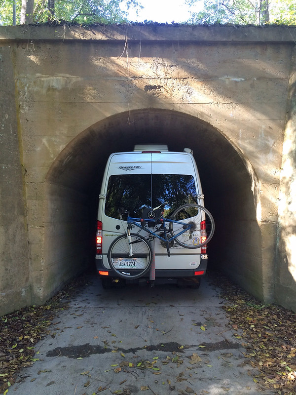
And when I emerged on the other side of the tunnel, I was in the campground I'd turned around at last year! The exact spot! Without even trying! And, I'd learned that Roxy can get in!
The campground had only a few people in it. If I'd been prepared I could have had a prime spot right on the Potomac! But, now I know for next time. I found place to park in the day use ares and got the generator going to heat lunch in the microwave. While I was waiting I pulled out the owner's manual to find out the official height of the RV - which I probably should have done *before* I went through the tunnel. The RV is 9 ft 6 inches. The tunnel was 10 ft 3 in so I had a mere 7 inches of clearance!
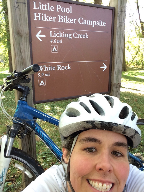
After lunch I took off down the towpath! It was already 1:00 and I still needed to drive home so I decided to only do 20 mile RT rather than going all the way to Hancock. I was about 4 miles down the trail when I saw a sign for the Western Maryland Rail Trail. I wasn't familiar with the rail trail so I made a mental note to look it up when I got home and continued. The crazy thing about the towpath is that it all looks the same, yet it's all different. Soon I'd reached the 120 mile marker and was going to turn around at the hike/bike in campsite right past it. Just before the campground there was a bridge that looked like it connected to another bike trail. I wondered if it was the rail trail? I rode down to the campsite, took a selfie with the sign so I won't forget where I turned around and went back to the bridge.
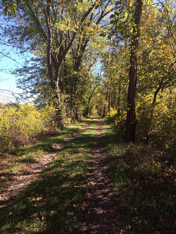
Sure enough the bridge lead to the Western Maryland Rail Trail! Turns out it's a paved bike trail that runs parallel to the towpath 22 miles from Ft. Frederick State Park to Sideling Hill Creek Aqueduct. So this whole section you can do loops! Ride one way on the towpath and back on the rail trail! How cool! I decided to ride back to where the rail trail had joined the towpath. It was really nice because the rail trail is paved and smooth and I could go faster! (The towpath is not paved) The other fun thing about the rail trail was that is parallel to I70. The same I70 that goes over Vail Pass in CO. I tried to pretend I was riding up Vail Pass, but Western Maryland just isn't the same.
When I got back to the towpath I had 4 miles to go to get back to the campground! It was going to end up being close to 25 miles! I was glad I hadn't gone for 30 miles. Both bike paths are flat, which sounds like a good thing, but it means you have to pedal the whole time! No downhill breaks! My thighs were screaming!
Back at the van I quickly got ready to drive home, it was 4:00 and would take me at least 2 hours to get home. I did take the scenic route and not the interstate which made for an enjoyable evening driving through the mountains!