Sunday, December 27, 2015

Beach Adventures

It's been a freakishly warm December here on the East Coast and with the summer-like temperatures coming right in the middle of winter break, I knew I had to take advantage! There were a few warm days before Christmas, but the warm weather came with pouring rain so it wasn't good camping weather. After Christmas it looked like the warmth would continue AND the rain was going to stop!

One of the challenges of winter camping is finding open campgrounds. I knew the campground at Assateague Island National Seashore was open year round and the beach is somewhat on the way home from my parents house in Williamsburg.

The Fog

We'd had a nice family Christmas with bike rides, Scattergories, fettuccine, and way too much fudge!

When I left about 2:00pm on Saturday it was misty and cloudy, but the temp was in the 60s. As I got closer to the coast the fog got thicker and thicker!

Just before the Hampton Roads Bridge Tunnel I experienced my first inspection station for my propane tank! The fog was thick going across the bridge that I could hardly see the water! There were a few hardy fishermen out there though!

The Cheasapeake Bay Bridge Tunnel was more of the same, fog as far as they eye can see - which wasn't far! This time however, no one inspected my rig to ensure that the propane was off, they just collected $13 and let me drive across. The Cheasapeake Bay Bridge Tunnel is neat because it's almost 18 miles across! It reminded me of the Overseas Highway in the Keys. There's even an island in the middle with a rest stop, gift shop and a resteraunt!

On the other side of the bay the road went further inland and the fog lifted! It was just cloudy and occasionally drizzly!

The Long Dark Night

Another challenge of winter camping, particularly in mid-December is how to deal with the long night. Sunset of Saturday was at 4:45 and sunrise Sunday was at 7:15 so 14.5 hours of dark!

Since I didn't leave until 2 I was going to spend at least the first hour of dark driving. This is good and bad. It meant less time to occupy myself in the campground, but I'm not a huge fan of driving at night and I really don't like coming into a campground after dark. I'd been to Assateague before so I kinda knew where things were and I was glad because it was really dark out there. The fog/mist and the clouds blocked out the full moon and there was no artificial light.

The park and the campgrounds were pretty much deserted! I saw 5 other campsites occupied! I found a site in the Oceanside campground that was right by the path over the dunes to the ocean! It was a big wide site with no trees or other obstacles, I was able to back in and get the RV perfectly in the site on the first try!

It was so dark and dreary it felt like it was midnight, but it was only 6:00! I started the generator and heated up dinner. I opened the windows and once I turned off the generator I could hear the ocean crashing right outside! After dinner I'd thought I'd go for a walk in the campground.

I grabbed my raincoat and headlamp and headed out. It didn't last long. The mist was so thick I couldn't see anything and the headlamp made it worse. I walked about 5 feet from the van and decided that I'd just go back in and read.

I was reading Pretty Baby by Mary Kubica - it's a psychological thriller and it was very good and not really scary, but reading the last 100 pages sitting in a deserted campground on a very dark and rainy night was a bit creepy! Luckily I had Becoming Chloe by Catherine Ryan Hyde with was more warm and fuzzy, to start when I finished Pretty Baby.

About 10 I decided it was time to go to sleep. I slept great. I had the window open and there was a chilly breeze - it was in the 50s all night - but I was in my sleeping bag. I woke up at 6 and it was still dark.

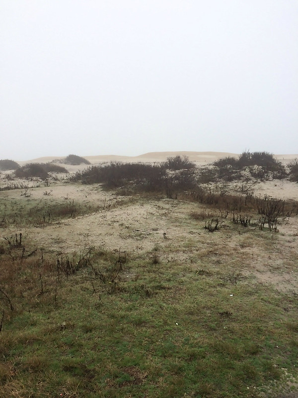
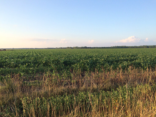
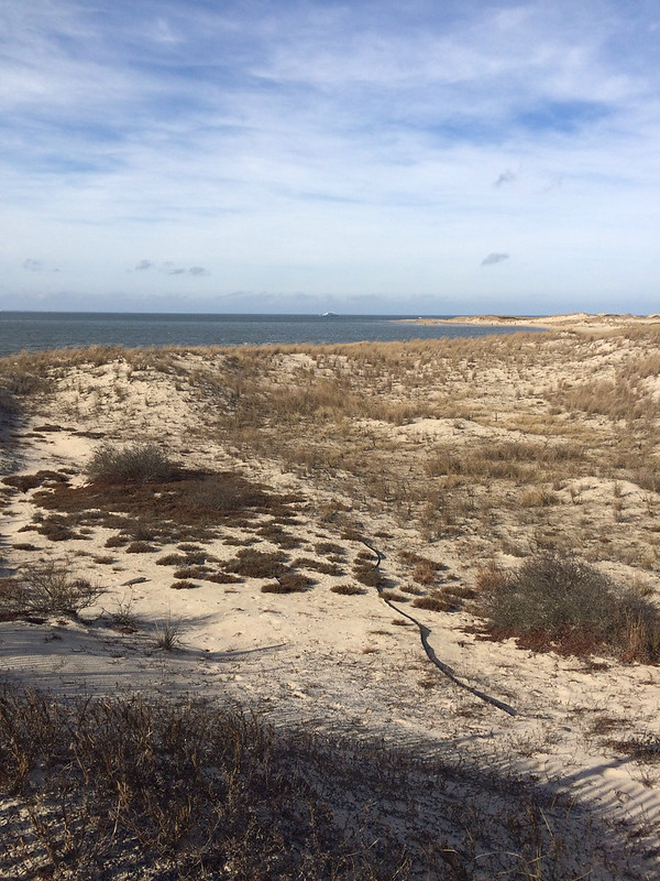
View from my campsite, if it wasn't foggy I would have had an ocean view.

I made the coffee and got dressed and settled in to read some more. Soon the sky was getting lighter and the sun was up! The fog however hadn't budged. If anything, it was thicker!

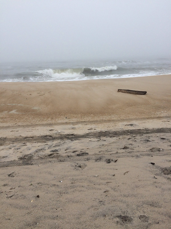
As soon as it was good and light out, I went for a walk around the campground and out to the ocean. It was too cold for wading, but otherwise pleasant, even if I couldn't see anything.


The Sun Comes Out

It was mid-morning when I started up the road to Cape Henlopen State Park. I drove up Route 1 to Ocean City and then up through the other Delware beaches. It took about an hour and a half and slowly the clouds lifted and the sun came out! By the time I got to Cape Henlopen the only clouds were high and thin! The sky was blue and the sun was shining! It was also quickly warming up!

I changed into bike shorts and a t-shirt and took off on my bike! I had no plan, no map, I just followed the bike path.

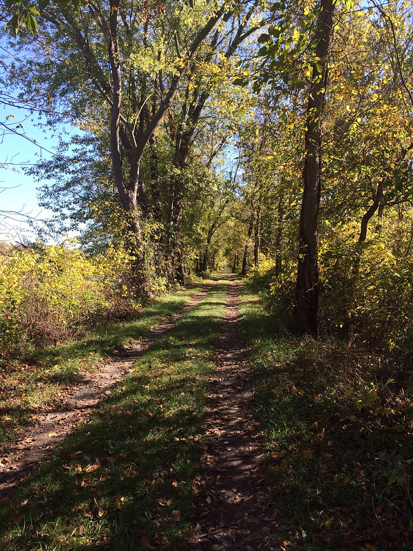
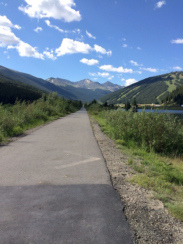
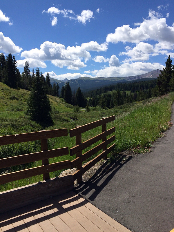
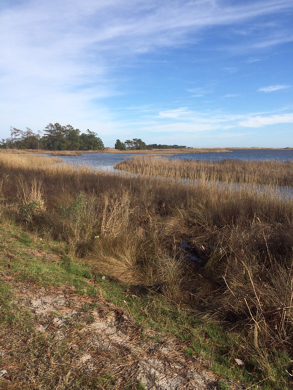
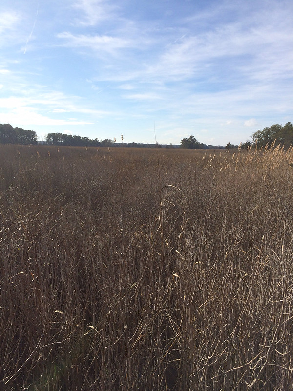
Cape Henlopen is a great place to ride your bike! They have several scenic bike paths - paved, crushed cinder, and totally off road - that can be linked together to get a good length.

I started on the paved Bike Loop and rode it around to the main beach area. I walked up to the beach but didn't go out on the sand (I'd had enough sand this morning!). Then I had to ride on the park road a bit to get to "The Point". I could have walked further out, but that would have meant walking on the sand, which I didn't want to do. I went back to the bike loop and continued around to the campground. I took a detour into the campground to check it out. After the campground I headed out the Salt Marsh Spur. This path was off road, but it was still smooth and easy to bike. That brought me to the Gordon Pond Loop. This part was the best part! It was wide crushed cinder and wound through the marshy area! It was 3 miles down to another parking lot, then you had to ride back! When I got back to the van it was earlier than I'd planned to leave so I rode the paved bike loop (3.3 miles) again! All told it was 16.99 miles! Should have ridden a few more feet to get an even 17, but my GPS is on my phone and it's in my backpack so I don't see it until I'm done.


It was 3 hours home and I'd wanted to get to the Bay Bridge before dark. The route before the bridge is a lot of country roads and it would be easy to get lost, but after the bridge it's just US 50 to the beltway, I've driven it bunches of times and don't mind driving it after dark.

I left Cape Henlopen at 2:30 and crossed the bridge with the sun low in the sky! I made it almost to the beltway before it was good and dark. It was stil 70* when I got home so I was able to unload the van while it was still warm! It's supposed to get cold tomorrow!


Sunday, October 11, 2015

C&O Canal Towpath

It had been two months since I'd driven the RV, we had a long weekend for Columbus Day, and the weather was gorgeous. Time for a field trip! I was driving the RV so I decided it would be a biking trip - I still don't have a bike rack for my SUV! Since I didn't make reservations anywhere I figured a day trip would have to do, I didn't really want to stay at a Wal-Mart. I loaded up the RV with just what I needed for the day and headed out to Hancock, MD to hopefully complete another section of the C&O Canal Towpath.

Last year, over Columbus Day I went to Williamsport, MD and rode a section of the towpath, but I could not remember where I'd turned around. Couldn't remember the milepost, a landmark, or even how far I'd ridden! I figured I'd prob gone 10 miles from Williamsport, so it looked like I could do a 30 mile round trip ride and complete the section from Williamsport to Hancock.

I headed out 66 to 81 to 70 and it was taking a long time. It was already almost noon and Hancock was still 20 miles away. I was ready to stop driving and start riding when I saw a sign on the highway for the C&O Canal Towpath: Four Locks and McCoy's Ferry. Good enough! I was heading there and I'd ride whatever section was there. Trying to be less OCD about riding the entire towpath and just enjoy a fabulous fall day!

I got off the highway and into the farmland of Western Maryland! At first the road was wide and nice! Double yellow line! I was following the signs and each road I turned onto got smaller and less well maintained! I had no idea where I was and I didn't even have a good map! I had my phone, only good as long as I have cell signal.

Soon I passed a the turn off to Four Locks and down the road I could have turned onto had a tunnel sign. That sign triggered the memory of where I'd turned around last year! I was at a snap NPS car camping campground that would be perfect for Roxy, but in order to get into it you had to go under the towpath and the tunnel was low, I wasn't sure if Roxy would make it. I was suddenly wondering where that campground was...today was the perfect time to find it and see if Roxy would fit. Maybe on the way back I'd explore. There was no way to turn around and get back to the Four Locks Rd so I kept heading to McCoy's Ferry.

Eventually the road narrowed to one land, then a dirt road went off to the right with a NPS sign. I'd missed going on the dirt road so I went up & turned around in a school bus turn around. Then I had to make the obtuse turn to get on the road to McCoy's Ferry. I managed to do a 4 point turn without too much drama - scraped the running board & thought I was stuck in loose gravel but no lasting marks. Then I saw the tunnel sign. Clearance 10 ft 3inches. Hmmm... I'm pretty sure I'm under 10ft....

I pulled up to the tunnel and attempted to look and see if the AC unit on top would clear, but I couldn't see. So I decided to put the window down, turn the radio off, and drive slow. I figured I'd know real fast if I didn't fit. I didn't hear any scraping! I fit!


And when I emerged on the other side of the tunnel, I was in the campground I'd turned around at last year! The exact spot! Without even trying! And, I'd learned that Roxy can get in!

The campground had only a few people in it. If I'd been prepared I could have had a prime spot right on the Potomac! But, now I know for next time. I found place to park in the day use ares and got the generator going to heat lunch in the microwave. While I was waiting I pulled out the owner's manual to find out the official height of the RV - which I probably should have done *before* I went through the tunnel. The RV is 9 ft 6 inches. The tunnel was 10 ft 3 in so I had a mere 7 inches of clearance!

After lunch I took off down the towpath! It was already 1:00 and I still needed to drive home so I decided to only do 20 mile RT rather than going all the way to Hancock. I was about 4 miles down the trail when I saw a sign for the Western Maryland Rail Trail. I wasn't familiar with the rail trail so I made a mental note to look it up when I got home and continued. The crazy thing about the towpath is that it all looks the same, yet it's all different. Soon I'd reached the 120 mile marker and was going to turn around at the hike/bike in campsite right past it. Just before the campground there was a bridge that looked like it connected to another bike trail. I wondered if it was the rail trail? I rode down to the campsite, took a selfie with the sign so I won't forget where I turned around and went back to the bridge.


Sure enough the bridge lead to the Western Maryland Rail Trail! Turns out it's a paved bike trail that runs parallel to the towpath 22 miles from Ft. Frederick State Park to Sideling Hill Creek Aqueduct. So this whole section you can do loops! Ride one way on the towpath and back on the rail trail! How cool! I decided to ride back to where the rail trail had joined the towpath. It was really nice because the rail trail is paved and smooth and I could go faster! (The towpath is not paved) The other fun thing about the rail trail was that is parallel to I70. The same I70 that goes over Vail Pass in CO. I tried to pretend I was riding up Vail Pass, but Western Maryland just isn't the same.

When I got back to the towpath I had 4 miles to go to get back to the campground! It was going to end up being close to 25 miles! I was glad I hadn't gone for 30 miles. Both bike paths are flat, which sounds like a good thing, but it means you have to pedal the whole time! No downhill breaks! My thighs were screaming!

Back at the van I quickly got ready to drive home, it was 4:00 and would take me at least 2 hours to get home. I did take the scenic route and not the interstate which made for an enjoyable evening driving through the mountains!


Monday, August 10, 2015

Pictures Slideshow

Just the pictures....for anyone who just wants to see pictures from the trip, click here!  Beware, there are over 600, but it shows almost everything.
Summer 2015

Saturday, August 8, 2015

Home

After 6 weeks, 44 nights, 21 states, and 7600 miles driven, I am now home in Northern Virginia! I drove from home to the Pacific Ocean and back!

I didn't write a blog post yesterday because all I did was drive. I did finish listening to The Supremes at Earl's All-You-Can-Eat. I ended up really enjoying it! The narrators did a great job capturing the characters personalities!

Another way I entertained myself while driving was to play the liscene plate game. I have a notepad shaped like the 48 contiguous states and it has the states outlined on it. I tape a page of it to the steering wheel (over the horn) and then just marked each state off when I see it. I'm good at geography so I can check off a state and barely look away from the road. Prior to leaving Sisters I'd seen every state (including Alaska and Hawaii) except Delaware. I decided to start over for the trip home. Between Sister's and home I saw every state except North Dakota, Vermont, and Rhode Island (again, including AK & HI!). I saw my first/only Delaware plate near Steeles Tavern, VA on I-81! I was about 150 miles away from not seeing a single DE plate! There were three vehicles from Delaware right together!

Tomorrow I'm going to work on updating my "States Visited" page and putting in links for all the State & National Parks. I'll also post a slide show/photo album with all my pics, but for now I need to go change the laundry...again...so much laundry when you get home!

Thursday, August 6, 2015

Shorter Drive

I had fewer miles planned today, a little break after a big driving day because the mileage didn't work out evenly! This allowed me to have a few hours to check out The Brown vs. Board of Education National Historic Site in Topeka, KS!

The Brown vs Board of Education site was very interesting! It was all about the end of segregation and equality for all. It was interesting to see the same themes as I'd noticed back in South Dakota with the Native People and we white folks marginalized them and took their land. We did similar things to the African Americans too. Makes me wonder what exactly our founding fathers meant by "all men are created equal". I'm glad for the folks who fought for civil rights!

It was noon before I left Topeka so I was glad I only had about 200 more miles to drive! I'd planned to stop at Graham Caves State Park, about 80 miles west of St. Louis. There weren't many camping options until well after St. Louis and I didn't want to do a Wal-Mart in St. Louis. (Remember the Griswalds, they got their hubcabs lifted in St. Louis! LOL!)

I arrived at Graham Caves a little after 4 and went to the campground. The first thing I noticed was that the campground was really far from the rest of the park and despite it seeming like Missouri is flat from the highway, in the park there were huge steep hills (steeper than Vail Pass!) so biking would have been hard. The next thing I noticed was that the campground was empty. There was a camp host and one other site occupied. I didn't like the way that felt so decided to check out the rest of the park then head to the commercial campground that was on the road in.

The rest of the park was just as empty as the campground and there wasn't much to see. There was a trail that went to the cave, but I decided not to hike it. I think it was just a cave to look at, not to go in.

I drove out and got a site a the Kamp Kan-Do Kampground. The misuse of the K rather than the C almost made me look elsewhere, but I didn't. It's an odd little campground, more seasonal residents than folks passing through but it's safe and seems quiet so it will do just fine for one night!

I ate my "long underwear" baked potato tonight...it was very good! The long johns worked just as good as foil!


Wednesday, August 5, 2015

Contrast

Today started here:


Loveland Pass, almost 12,000 feet.

And ended here:


Salina, KS - this view is what most of Kansas looks like!

All I did today was drive! I chose to drive over Loveland Pass rather than take I70 through the Eisenhower Tunnel because I wanted to see more of Colorado before I hit Kansas! It was 6 miles up with 3000 feet of elevation gain, and 4 miles down, although once I got on 70 I was still going down for probably 15-20 more miles.

Once I got to Denver I was past the mountains and the flat farm county started. The eastern half of Colorado is exceptionally boring, but once you get into Kansas the scenery improves a bit. It's still flat and open with some rolling hills but it's more farms and there are even some trees!

I actually don't mind Kansas much, I think it's better than Nebraska, South Dakota and Montana! The first time I drove through Kansas I thought it was very remote and that there was nothing here, now after having been places where there is actually nothing Kansas seems very populated! There's fuel and resteraunts and stuff at almost every exit!

The big thing today was keeping myself entertained while I drove! I'm listening to another book, The Supremes at Earl's All-You-Can-Eat by Edward Kelsey Moore. It's a good light read, I still don't really like listening vs reading, but it does help the miles go by. I can only listen to the book for a few hours at a time and today I finally let myself listen to Pandora. I have a "favorite bands" channel that I've created and I love it, but it uses data, I'm not sure how much, I hope it's not much because I really enjoyed listening to Pandora today!

I was going to stay at the Wal-Mart in Salina but I drove down there - it was 4 miles off route - and it didn't look good, looked noisy and at 6:00pm there weren't any other RVs there, so I drove back to 70 and went to the KOA. I have a nice site with electricity and cable! I've never hooked up to cable, I have a very short coax cord that usually doesn't reach, but here it does! I haven't watched TV since I left home so it was exciting to watch Modern Family over dinner and Big Bang Theory while I'm blogging! I also met some nice folks from Louisana parked next to me. And, I cooked my baked potato so it would be ready when I'm ready for dinner tomorrow. The directions yo cook a baked potato in my convection oven were to use the "compucook" feature and then wrap the potato in foil for 15 minutes. I don't have any foil, but I figured it needed to insulated and keep the heat in while it finishes cooking, so I wrapped it in my long underwear...here's hoping it works!


Tuesday, August 4, 2015

Vail Pass

Today I was taking the day off! No driving! Well, not much driving. Despite this area having fabulous bike trails I had some things to do that involved driving!

Before I ran errands I was going to attempt to ride up to Vail Pass. Yesterday I drove over Vail Pass, there's a bike path that goes right down the median of I-70 and you can ride your bike all the way up from Frisco! When we were here 2 years ago Mom brought Dad and I up and we rode down (this was before I had a bike of my own so I was riding her beach cruiser, I wouldn't have made it up if I'd tried!). Now I was here by myself and if I wanted to ride down, I had to ride up! It was about 15 miles(one way) from the campground with about 1500 feet of elevation gain (from 9,000 ft to 10,500 ft!). The path is well graded but it is still a lot of uphill no while we've been at 3,000-6,000 feet off and on for the last few weeks, it's different from being at 9000+ feet!

The ride up Tenmile Canyon between Frisco and Copper Mountain Ski Resort wasn't so bad! It was a steady easy grade and it even leveled out close to the ski area so I got a break! I remember this being my favorite part to ride down last time, the gentler grade is easier both up and down. The wind however was making things hard! It was a headwind and peddling into it, going up, was a challenge!

I took a break for a snack after I'd gone through the ski area, just before the trail went up to the pass. While I was stopped a two guys came up, both over 50 and one was wearing an Ironman jersey, and they were asking some folks who just came down about the wind, thinking it might not be worth it to ride up today because it was so windy. I guess I wasn't the only one fighting it! We all pressed on however! I assume the guys made it to the top, I didn't see them again!

As I got higher the views just got better and better! These mountains are huge! The area around the trail after Copper Mountain is an alpine meadow and the wildflowers were all in bloom! More flowers that I saw in all of Oregon! I enjoyed seeing the things we did this whole trip, but my ride up to Vail Pass this morning might just be my favorite thing I did! Colorado is amazing! And so much closer!


I made it until the last mile before it was just too much to continue! I think it was a combination of the wind, the elevation and the steepness. I knew I was close to the top though, so I walked! There were a few spots where even walking was tough with the wind!

At the top I had a snack and took in the view before heading down! It had taken me 2 hours and 45 minutes to get to the top, took me and hour and fifteen minutes to get back to the campground! (That time includes stop time, I didn't stop at all on the way down).

It was almost 1:00 when I got back to the campground. I got lunch and did a few things at the RV, then went into town to get fuel, buy some more underwear so I didn't have to do laundry, picked up a few things at the grocery, and went to the town dump station.

After my errands I took the bike out again. This time I rode the trails closer into town. I rode to the Frisco Marina and got the Lakeside trail out to the dam. This route took me past what I'd thought was the best campground in town, but I realized it it's not really! The campground I'm at, Pine Cove, is about 2 miles from Frisco, it's not really on the bike path, but it's close. Heaton Bay, which is on the bike path, is at least 4 miles from Frisco and 4 miles from Dillon! I'd wanted to ride at least 10 more miles to give myself another 40 mile day, but then I started thinking I might be able to go 20 more miles have a 50 mile day. The riding seemed easy and I was worried that this was because I had a tailwind and didn't know it, so ended up turning around about 2/3 of the way across the dame after almost 8 miles. Turns out the path was just easier, it was just as easy coming back! I did get in 15 miles, making it 45 for the day which is still a personal best!

When I got back I fired up the generator to fix dinner & charge the batteries got a shower and settled in to enjoy the evening. The weather today was perfect. Chilly overnight (I got out the sleeping bag!) but not frigid, warmed to the mid-70 but with the breeze it was cool!


Monday, August 3, 2015

Arches National Park

I'd wanted to get an early start on my morning in Arches so I wasn't too disappointed when I woke up at 4 and couldn't get back to sleep, then the fridge cut off around 4:30 and I was awake for good! One nice thing about sleeping in a parking lot is you can leave whenever you want without worrying about disturbing anyone! I didn't want to drive into Arches in the dark so I got all ready to go and waited until almost 6 to leave.

The sun was just coming up as I was entering the park! It was a nice time to be there! I made it to the Delicate Arch Parking Area and was hiking by 6:45! I was not the first person to the trailhead either! This is a very popular hike!

It was only three miles to the arch and the trail went through all the desert highlights! It went across sand, open rock, even rock ledges before we finally came out at the arch! It was amazing! It was so big! There were only a few people there and I was able to get several pictures without any random strangers!


It was 7:40 when I was at the arch and on the way back I was like a salmon swimming upstream! There was a constant parade of people coming up and I was the only one coming down! I was back in the parking lot at 8:15 ready to explore the rest of the park.

I went to see the Arch Overlook, where you can view delicate arch without hiking. It was a mile away but it looked so tiny! And you could see all the people on the rock looking at it! So many people had gotten there, just since I'd left!

Next I went out to the Devil's Garden area. That area looked really neat, but it was a 7 mile hike to see it all so I only walked about a mile to landscape arch then turned around.


After that I drove out to the windows area of the park. This is where the crowds caught up with me! I hadn't had any trouble with parking until I got to Windows, there was no place to park! I found an only slightly illegal place to pull off and walked back to a view.

Since the park was filling up and I still needed to drive 250 miles today I headed down the hill to the visitor center to get my passport stamped and head up the road.

I-70 through Colorado is the most scenic most amazing section of interstate and I was very excited to get there! But first I had about 70 miles of Utah desert. Between Moab and Fruita, CO there is nothing but sagebrush. You can see the big mesas in the distance and at one point I saw what looked like the Devil's Garden area of Arches, but I'm not sure.

Colorado was just as lovely as I'd hoped! There was construction through Glenwood Canyon and it rained a bit but Vail Pass was spectacular! I wonder if that ever gets old?

I got to Frisco at 4:30 and found a campsite - there weren't any sites in my first choice campground, Heaton Bay - it's got electric hook ups AND easy bike path acess, but I got a nice site by the water in the "parking lot" campground. After I parked I hopped on my bike and rode into Frisco for dinner! I'd been planning to get a pizza from The Hot Tomato in Fruita, but they aren't open on Mondays! I went to Peppino's in Frisco and it was very good!

I love this area because it's got great mountains, tons of National Forest Service campgrounds, and a large system of paved bike paths. It was here two years ago where I got re-introduced to biking!


Sunday, August 2, 2015

Canyonlands National Park

I was up early to get on the road again! For a few weeks now I've been debating stopping in Moab, Utah on my way to Colorado. I'd almost decided to just do it, then Mom and Dad and I were talking and they were telling me how hot it is in Moab and after the heat in Sisters and the heat yesterday I wanted no part of another hot night, especially when I wasn't sure where I could camp and I knew if I moved quickly I could get to Frisco, Coloradao which is at 9,000 feet and nice and cool! I left the Wal-Mart in Burley with plans to go to Fruita, CO for the night then on to Frisco tomorrow.

The desert scenery didn't change much through the rest of Idaho, however, once I crossed into Utah the hills started, little at first and then bigger! By the time was was on I-15 south approaching the suburbs of Salt Lake City there were huge mountains on the eastern side of the road! I never saw The Great Salt Lake, but the mountains were cool! Very arid still, but high and jagged!

One of the Utah liscene plates has Delicate Arch, in Arches NP, on it. I kept seeing the liscene plate and thinking, "I really should stop at Arches." Even though I thought I'd decided what I was doing, I was still debating it with myself. I'd checked the weather forecast for Moab last night and it was calling for highs in the 90s, lows in the upper 60s...

I stopped for fuel in Provo, Utah (the name rings a bell but I can't figure out why or what's there that I know.). While I was stopped I checked the weather in Moab again. They had a flash flood watch and the temps were lower...hmmm... I also looked up Moab on overnightrvparking.com to see if there were any places that allowed overnight parking in case I couldn't find a campground. Sure enough, the City Market allows RVers to stay overnight!

Once I got off on US6 the scenery improved dramatically! We were now going over the big mountains to the east! As we climbed I noticed the clouds building and the temperature dropping! It barely hit 80! I'd pretty much decided that I was taking the side trip to Moab and the cooler temperatures helped seal the deal!

US6/US191 was a great drive! We went up and over the jagged mountains! There was lots to look at! It was definitely very "desert" with lots of sagebrush and scrubby stuff but it was pretty! It was about 150 miles to the turn off to Moab.

In my head I'd been going to Moab just to go to Arches NP, however, on the road today I saw a billboard for Moab that said "Two National Parks: Canyonlands and Arches. At a rest stop I googled Canyonlands. It wasn't quite as easy to get to as Arches, but if I was going down there I had to go to both!

I made a split second decision to go out to Canyonlands this afternoon, before I even came into Moab! It was 25 miles out the road, but I wanted to get there before the visitor center closed - if I was going there I was going to get my passport stamped!

The road was just amazing! You have to go up on the Mesa to see the canyons so the road went up up up! There are huge rock formations on all sides! Once at the top of the Mesa you still had several miles to drive before coming to the entrance station. Dead Horse State Park is also up there but I didn't stop - it cost $10 to go in & I didn't have enough time, this is the short tour!

I stopped at the visitor center and got my passport stamped, then walked out the the view of the canyon! WOW! It's amazing! So colorful and big! I walked along the rim of that canyon for a little ways, then decided to drive out to the campground to see if there were sites. The park is very big and you have to drive everywhere. I was hoping I could get a site at the campground the ride my bike. No such luck. Campground was full - they only have 12 sites.


I stopped at Green River Overlook and then went out to Grand View overlook. At Grand View there was a trail that went along the rim and I walked out that. It was a mile long and I didn't go to the end. The clouds were building and it looked like it was going to storm and I didn't want to get caught out in the rain.


By now it was after 5 and I decided I'd better head down and figure out where I was sleeping tonight. The town of Moab is very touristy - lots of shops and resteraunts, not nearly as nice as Sisters! I had to go all the way through town to get to the City Market, but they do in fact allow overnight parking!

I walked through town then went into the City Market for a few things before heading home! Almost all the tourists looked like they just stepped out of the L.L. Bean catalog! As soon as I got in the van it started raining! It's been raining all evening, and there's even been some thunder - loud booming thunder that echoes on all the rocks! It's very cool and comfortable too! I got incredibly lucky that my one day to come to Moab is the day that it's raining and cool.


Saturday, August 1, 2015

Goodbye, Oregon!

It's been fun exploring Oregon! It feels like it was a year ago that we arrived in the Columbia River Gorge! But really it was under a month ago! We explored almost every part of the state and found something special and unique in each spot! My favorites were the coast and Crater Lake, but the Gorge and all the volcanos were cool too! Usually I plan to be home by August 1 so I can do stuff at home and prepare for the next school year, but in order to have time to get all the way to the West Coast and do stuff here I had to extend my trip and now it's Aug 1 and I'm only beginning my 3,000 mile journey home. I plan to take at least a week, maybe 10 days. I will be home by August 10.

I left Sisters a little before 8, stopping in Bend for fuel at Fred Meyer and finally getting my own Fred Meyer card! Saved me 3 cents a gallon! Then I took US20 east from Bend toward I84. It was 260 miles through the high desert! The first 120 or so miles were flat sagebrush. Just sagebrush as far as the eye can see. After Burns it got hillier, but they were rocky scrubby barren hills. I didn't find it very interesting and it seemed to on forever. Eventually it became more farmland as we approach Ontario where I got on I84 south.

Almost as soon as I got on 84 I crossed over into Idaho. There weren't any places to stop along US20 and we crossed over into Mountain Time, as a result it was almost 2:00 and I hadn't eaten lunch! I pulled off into the first rest stop for some snacks. While I was stopped I left the iPod playing and it played the B-52s "Private Idaho"! LOL! Well played iPod!

The scenery in Idaho wasn't much better. Lots of desert here too! Even the town of Mountain Home is surrounded by desert! Crazy! And, it was hot! Between 100 and 106 all day! As soon as I'd stop the van would get super hot very quickly. Because of this I decided to keep driving after my usual stop time. I planning on going to Wal-Mart, and sitting in the Wal-Mart parking lot when it's crazy hot just isn't fun, I'd rather keep driving and get in later, hopefully after its starts to cool off.

I pulled into the WalMart in Burley, ID a little before 7. It wasn't appealing to sit in the parking lot so I decided to explore a bit. Less than a mile from the WalMart I found a lovely park right on the Snake River! It had plenty of parking and boat docks floating on the water that you could sit on! I heated a frozen dinner in the microwave and went and sat on the dock and had dinner down by the river! It was much cooler down here and I could watch the boaters and jet skiers on the river, until the mosquitoes started biting! If the Sea Eagle didn't leak I could take it out, lots of folks in every kind of boat!

While in the park I discovered a dumpster. And unsecured dumpster! This was exciting because the van needed DEF and I had two 2.5 gallon boxes that I'd got a Wal-Mart but I was planning to wait until morning to put it in since everything was hot and would been cool then. But, the lure of having someplace to dispose of the empty boxes made me want to go ahead and do it. I needed to use my oven mitt to open the hood and the DEF filler, but I got it done!

Friday, July 31, 2015

Camp Sherman & Scout Lake

Last day in Oregon! To play that is, I have almost 300 miles of Oregon to drive through tomorrow!

It was going to be another hot one so Dad and I decided to head out early to do a bike ride that was suggested to us by the Ranger at the Ranger Station yesterday. We drove up to Camp Sherman, which is a summer/"resort" community up along the Metolis River in the Deschutes National Forest. There are a few lodges, a few commercial campgrounds, some summer homes and a bunch of National Forest Service campgrounds, as well as a neat little store.

We parked at the Camp Sherman store and rode out bikes up Forest Service Road 14, unlike most Forest Service Roads this one was paved and made for a nice bike ride. It was rolling, which I like because it's not all up or down, but there was more downhill on the way out. We rode all the way out to Lower Bridge Campground and back - about 15.5 miles round trip. On the way back we avoided the big hill by taking another paved Forest Service Road that went down by the river.

After our ride we checked out the Camp Sherman Store! I was very impressed by the quality of products they carried, it was a lot like an organic grocery store! We also went to the head of the Metolis River, it appears to come right from under the mountain!

We came back to Sisters for lunch. We stopped at the campground and got Mom and changed out our gear - put the bikes away and got swimsuits and other things needed to relax by the lake for the afternoon. We had lunch at the Fir Street Market, a natural and organic grocery store/cafe in Sisters. The food was fabulous! I had a salad and it was all very fresh and crisp. After lunch we had to go back to BJs Ice Cream for some more Oregon Trail ice cream.

Sufficiently fed we headed back out US20 into the mountains to Suttle Lake. Suttle Lake is a huge lake with a resort, at least three campgrounds and a boat launch, but best as we could tell, no day use area for lounging and swimming. There were folks who had set up in the boat launch area but there was little shade. There was another lake up the road, Scout Lake so we headed up there. This lake turned out to be perfect! It was much smaller, but there was plenty of shade on the shoreline and there were lots of swimmers!

We stayed our claim under a tree and I quickly got in the water! I love swimming and my favorite place to swim is in a lake! Especially one like Scout Lake where there is no set swim area and you can just go wherever! There were a lot of people in the lake, many with floats and kayaks and stand up paddle boards. There were also a lot of dead trees floating in the water, which was fun because you could sit on them and I even "paddled" one around the lake for awhile, but it made it hard to really swim because of fear of running into something! I swam all the way across and back - the lake is bigger than it looks and floated around on a log for awhile! A family of ducks even swam over and shared my log for awhile! It was a wonderful spot to spend a very hot afternoon.


On our way out we discovered the Suttle Lake Day Use area, it was by the lodge and it wasn't nearly as nice as the Scout Lake Day Use area so it ended up working out the best.

We got back to Sisters around 5:30 and went to a neat Mexican resteraunt for dinner and then came back to the campground to run generators and clean up - I'd pulled out all kinds of stuff today and hadn't even cleaned up breakfast because we wanted to get going before it got hot.

Around 7:45 Dad and I set out on our bikes to go back to the Snow-Cap for blackberry shakes! It's only about a 1/2 mile from the campground but it was a nice ride, the sun was setting and it was getting cooler!


Thursday, July 30, 2015

The Grand Tour

It stayed warm most of the night, slowly dipping into the 40s, after it being so cold the last few nights I had prepared for a cold night - long pjs, extra blanket, closed the windows at the first chill, this meant I was hot almost all night! It was nice to wake up to warmer temps and be able to enjoy breakfast at my picnic table rather than huddled in my sleeping bag inside!

Our first stop of the day was Sisters Bakery. We'd walked by there yesterday and Mom wanted to try one of their doughnuts. I had a taste of Mom's doughnut and Dad's energy bar thing, both were good! We talked to someone who's been to bakeries all over Oregon and he says Sisters Bakery is one of the best! After our snack we went to the National Forest Service Ranger Station to find out about hikes and bike rides for tomorrow.

Next it was off to Smith Rock State Park. Smith Rock is a big deal fir rock climbers, it's one of the premier spots in the country for rock climbing. It's a huge volcanic rock uprising, it's really neat to look at, but it's all exposed with no shade at all. And it's out in the desert and it was over 100* today. They had some trails that looked interesting, but it was so hot and sunny and uncomfortable to enjoy them. Dad and I did hike down into the canyon and along the Crooked River - it was maybe 2 miles, probably closer to 1.5 - it was nice but so hot!


On the map of Smith Rock we saw The Cove Palisades State Park. We'd never heard of it and it was close so we went to check it out. This park was right below a big lake where they have dammed up the Deschutes River and the Crooked River. Two lakes had been formed with a giant butte in the middle. We sat by Crooked River lake for a little while, it was cool in the shade. There was a swimming area but it wasn't really appealing for swimming - lots of plant debris and stuff floating. Both lakes were down in canyons with high volcanic rock sides. The lakes were nice but the rest of the landscape was hot and desolate.

We noticed on the map that we could get back to Sisters a back way from this park so we set out. Turns out the back way was all desolate, isolated, dirt road. No houses, no towns, just dust, scrub pine and sage. The high desert at its finest. And hottest.

We got back to Sisters at 3:30 and decided it was time for a treat. We stopped at one of two ice cream places in town. All homemade ice cream with no junk! The Oregon Trail with chocolate ice cream, blackberry swirl and hazelnuts was very good!

After ice cream we headed up McKenzie Pass. I was expecting a normal mountain pass where you get to the top and you can see all the other mountains, maybe there's a meadow up there or maybe just trees. Well, not here. This mountain pass was a lava flow. Of course it was. All of Oregon is volcanic! It was actually pretty neat - it was lava rock as far as they eye could see! We also had views of the Sisters, Mt. Washington, Three Fingered Jack and Mt. Jefferson, Mt. Hood was out there too but hard to see (we'd seen Mt. Hood earlier, bringing the trip full circle as we'd started there back at the beginning of the month.). At the pass there was a 1/2 mile interpretive trail, paved with signs about all the volcanic features and an observation tower.


Next we set out to find the other pass - the signs said we were on a scenic road that included two passes, I can't remember the name of the other one. When the road was headed steeply downhill we figured the other pass wasn't on this road so we asked the GPS how to get back to Sisters and it took us another back way - lead us out to 126 and back to US 20. This took us down the other side of the mountains which is not in the desert! It rains here! These woods were lush and green and cool! The total opposite of the terrain on the Sisters side of the mountain. We found several hikes that we could come back and do tomorrow as well as a lake to swim in!

By this time it was 7:00 and we needed to get back to run our generators and eat dinner. After dinner we decided to go check out the other ice cream place in town - I don't remember it's name but it's a drive-in type place right on the edge of town. I had an amazing blackberry milkshake! Real blackberries! Yum!


Wednesday, July 29, 2015

Biking LaPine State Park

Today ended up being a transition day, we didn't do anything too exciting, but we got stuff done that needed to happen.

It wasn't quite as cold overnight, but it was colder than I would have expected for July! It took the sun a long time to get up over the trees where it could warm my RV. I ended up having breakfast in bed again! I was just about ready when Dad came over, he wanted to ride some of the trails in the park before we left.

As you all know, Dad and I are not mountain bikers and the times we've attempted to ride on trails has never ended well. All the trails through LaPine State Park appeared to be wide flat packed sand, and there were no signs saying "no biking" and there were tire tracks on all the trails we'd seen. So, we decided to try it.


For the most part it was fine - wide and packed, flat, and easy to ride. There were spots where the sand was softer and that was hard. We did a loop with the Deschutes River Trail to the Fall Creek Trail. The Fall Creek trail was narrower and had more obstacles - little things like roots, rocks, soft sand, curves, bushes, up hills, downhills, things you'd never notice walking but that conspire against you when you are biking! I had to get off and walk a lot because I'd lose my momentum to a soft pile of sand or the downhill was just too twisty and steep. When we came back around and I saw an RV through thr trees I knew we were back in the campground so I bailed on the trail,and hot back out to the road. Dad was really far ahead of me so I couldn't tell him. Once on pavement I was zooming along and I got back to our sites at exactly the same time he did.

The scenery was not that interesting. Pretty much just Ponderosa Pine. If we were hiking it would have been really boring, and hot. At least biking made it more challenging and interesting. It was about 8 miles so would have taken us all day to walk, it only took about 2 hours to ride.

After our bike ride we went into Bend and got some fresh veggies at a farm stand, did the rest of the shopping at Fred Meyer and Dad went to fetch the mail.

After the shopping we drove the 20 miles to Sisters and we will be here through Saturday, when I head back to the east coast. On the way to Sisters we had great views of the Three Sisters Mountains, Mt. Bachelor, and I think Mt. Hood. After dinner we walked into the town of Sisters. It's a cute little town, but at 8:00pm everything was shut down.

We are now in the high desert area of Oregon. It was in the 90s during the day today (when I left the Fred Meyers the van said it was 106*! That was on the hot pavement in the sun, it quickly fell to about 95) and tonight it's going down into the 40s!


Tuesday, July 28, 2015

Kayaking on the Deschutes River

It was another cold night at Mazama Village! It was 45* inside when I woke up! We didn't have anywhere to be this morning so I didn't even get dressed right away, I made coffee and ate breakfast in my long underwear snuggled in my sleeping bag. After yesterday's experience of it being 10* colder outside vs inside I didn't go out or open the door until I was ready to go see when Mom and Dad were ready to go, and when I did go out I discovered that it was very nice outside! The sun had come up and warmed everything up, except the inside of my RV!

It was about 10 when we rolled out, heading for Bend, or near-ish to Bend as it turns out. I stopped to dump and to get some last pictures of the lake and Wizard Island. The rest of the drive was unremarkable and soon I was in La Pine. La Pine is a small town about 20 miles south of Bend and there was La Pind State Park was in one of the campground books so we decided to see if they had sites, and they did, for tonight only.

The park is nice, but it's not as scenic. It's mostly just pine forest and sand. It was very sunny and warm this afternoon and hiking wasn't appealing. The park is home to Oregon's largest Ponderosa Pine so we had to check that out. It was underwhelming. The Deschutes River flows right through the park and it looked kayak-able so we scouted a good put-in (trail right by our campsite lead to River access) and take out spot (by the big tree) and came back to get the boat ready!

I carried the Sea Eagle inflatable kayak under the bed all last summer and we didn't use it, and I've had it this whole trip and we haven't used it, so it was good to get it out! We inflated it and noticed air escaping from the right gunwale. We secured the valve and figured the problem was solved.

We had to walk about a 1/4 mile down a sandy trail to the water. The river access spot wasn't the best put in - the water looked to be moving fast and it was deep. Dad had decided to bring a rope and tie the boat to a tree and then let it loose when we were in. Turns out the rope was a bigger problem! We both got in easily and then the rope got caught on the tree! We left the rope and came back to get it!

As we paddled along we realized that the current that looked strong from shore, wasn't really that strong. And the scenery was very repetitive. It was nice, but once you'd seen a 1/4 mile of it, you'd seen it all. Also, it appeared that the right gunwale was losing air, but we weren't sure. The boat was definitely listing to that side.

There was a side channel that looped back to the main channel and we paddled down that. It either had no currently or we were paddling upriver, because we were both paddling a hard as we could and getting no where. I guess we'd underestimated how strong the current really was! As we came around the bend heading back to the main channel it looked like it was all grass. It appeared that our side trip was a dead end and we'd have to turn around, or portage. But luckily there was a narrow channel in the grass, just wide enough for a kayak.

Almost as soon as we were out in the main channel again we were at the Big Tree, which was our take out point. We easily got the boat to the shore and hopped out. The water was cold! Not as cold as Crater Lake, but cold! Dad texted Mom to come get us and we hauled the boat up the hill to the parking lot. It was obvious as we walked up that the right gunwale had lost a lot of air. Dad had is kayak straps so rather than deflate the boat in the parking lot we decided to put it on top and bring it back inflated so we could investigate why it was leaking.

After Dad and I both looked at it and determined that it may not be a problem we can fix. It's complicated to explain here. I like having the Sea Eagle, for days like this, but the fact that I never used it last year and we've used it only once this year means that if I can't come up with a fix, I'm probably not going to replace it. Inflatable kayaks aren't cheap. This was one of the cheaper ones. I may have a lot of extra space under the bed...especially because we decided that my custom made leveling blocks are a waste of space because they don't remedy the van being out of level so Dad took them since they are nicer than his blocks and we had a campfire burning his old leveling blocks! So, no big bag with the kayak, no big leveling blocks means all I have is a chair and my bike pump!


Monday, July 27, 2015

Wizard Island

Today was the day for our boat ride around the lake with a three hour side trip to Wizard Island! To get the boat we had to travel back up to the rim, then drive about halfway around the lake to the Cleetwood Trail Head, then walk 1.1 mile downhill, 770 feet downhill, to get to the boat dock. There is a lot of construction along the west rim of the drive and they said to allow an extra 40 mins to get through it.

It got really cold last night! I was sleeping in my long undwear and got in my sleeping bag and closed the windows! The coldest morning was also the earliest morning since Dad and I decided we needed to leave by 7 to ensure that we had enough time to make it to Cleetwood dock to get the boat at 9:45! The other cold mornings I've been able to get up a bit later after the sun has come up!

The temperature in the RV this morning was 46*, I didn't turn the heat on because I hate the smell of the burning dust and the propane furnace almost always sets off the CO/LP detector! I just got dressed and crawled back into my sleeping bag and ate breakfast in bed...like a real camper! LOL! When Dad picked me up the temperature in the Jeep was 37*, and it fell to 34* on the way up to the rim! BRRR! I was impressed that it was 10 degrees warmer inside versus outside though!

We didn't run into any traffic from the construction, we went through before they started, and arrived at the parking area by 7:30. We needed to be there by 8:45. So we were a bit early, and it was too cold to walk down to the dock early, so we drove a little ways down the road then went and sat in the parking lot. We saw lots of people going down to the dock in shorts and t-shirts and kind of thought they were crazy. We figured it was going to be super cold out on the water with the wind and yesterday was so cold all day. We had all the cold weather gear!

Turns out we were the ones that were over prepared! As soon as the sun got up good it was hot! We were taking off layers of fleece and stuffing them in our backpacks and trading fleece hats for sun hats. The air was cool, but the sun was hot and intense! And today was a glorious clear day with no wind! This was great for watching the colors in the lake! And the boat ride was calm - the afternoon wind makes the boat rides rough sometimes.

The boats are small, they hold 37 people I think, and we had a Ranger with us who narrated the whole tour! A lot of the information she had was similar to the movie yesterday but it helped to be seeing the things she was talking about! We learned more about volcanoes than I ever wanted to know!


After about an hour on the boat we arrived at Wizard Island! Wizard Island is a cinder cone volcano that formed after Mt. Mazama erupted, it emerged after the lake was formed! It's named Wizard Island because it looks like a Wizard Hat! (Of course almost all cinder cone volcanoes look like wizard hats!) on Wizard Island there are two trails - one to the summit and one to Fumerole Bay. If you hike to the summit you can walk all the way around the rim and even down into the crater. You can also fish (the fish don't belong in the lake, they encourage the catching of as many as you can and removing them from the lake), swim (yes, swim, it's allowed, but the water is cold) Dad and I hiked up to the summit as soon as we got there, the views were amazing! The lake was at least 9 different shades of blue! I walked all the way around the rim, Dad walked down into the crater.


I really wanted to swim in Crater Lake, but the cold water temperature (about 55*) combined with the cool air temperature (60s during the day, but remember that hot sun...) and the cold morning made me rethink my plans. After our hike we had about 30 minutes before he boat was coming back so I went down to the dock and stuck my feet in! The water was very cold! My feet never really got used to it, but it did feel good!


Because the water in Crater Lake is so pure - it's all snowmelt and rainwater - it's incredibly clear!

After our time on Wizard Island we got back on the boat and continued our tour of the lake. We went past all the features we'd seen yesterday - Pumice Castle, the Phantom Ship, only now we were down on the water! We had many chances to look at the water and see how crystal clear it is and to examine it's color.

It was 3:00 when we returned to the boat dock, ready for the 1.1 mile uphill hike - re-gaining the 700 feet we lost thus morning! There were lots of people at the Cleetwood Dock area, some were swimming, many were sunbathing on the rocks. Cleetwood Cove is the only place where you can access the water. I still kinda wanted to swim, but I'd have to walk up the hill wet and I didn't want to do that. Once back at the parking lot we saw the traffic backup from the construction, it didn't take long to get through it though, and soon we were back at the campground ready for an early dinner!


Sunday, July 26, 2015

Crater Lake National Park

Woke up to a very chilly morning! I kept my long underwear on until 10! It was very refreshing! I actually used my sleeping bag this morning! And, it wasn't as cold as it will be tomorrow morning! Its forecast to go down into the 30s tonight!

The first thing I needed to do this morning was buy tickets for the Wizard Island cruise for tomorrow. I couldn't buy them until 9:45 this morning, my plan was to be first in line at the kiosk in the gift shop. I decided I needed to be there by 9, which is very late for me, I was ready to go by 8:20, and that was after I'd slept in, and had a leisurely breakfast with my kindle.

Mom and Dad were staying at a casino about 20 miles away and coming in this morning to get a "first come, first served" site. I realized that I could probably pay for their site before they got here. This campground operates differently from any other campground I've been in. You either make a reservation (50% of the sites are reservable) or you show up at the kiosk. You pay your money and tell them what type of site you need - tent or RV and how long your RV is. They give you a card with your departure date and a color, you can then go and pick any site of that color (the colors tell how big the sites are, I'm yellow (even though I could fit anywhere!) and Mom and Dad are red), you can even move sites if a better one opens up! You just put your card on the site post. This makes it very easy to extend your stay, just go pay again and the site is yours! So anyway this morning I went up and bought Mom and Dad a site before they got here. It ended up getting very confused because Mom and Dad came in while I was at the boat ticket kiosk and the guy I'd talked to about thrust reservation was on a coffee break! We did eventually get it worked out, and I paid for my extra day so I could stay three nights!

I got to the boat ride kiosk about 8:40. A whole hour before I could make my purchase. I'd brought my Kindle so I stood there and read. About 9:20 a family came up and got in line behind me. A few other people came up and bought tickets for today. Then finally at 9:45, I clicked through the screen and made my purchase!

Camping spots secured and boat ride tickets purchased, we were now free to explore the park. After an early lunch we set out for the rim. I decided Mom and Dad needed to see the lake first, before going to the visitor center or starting the drive, so we went directly to the rim. The lake is just awesome! Pictures will never do it justice, you all just have to come.


After checking out the lake at Rim Village we went back down to the visitor center to watch the movie. At Lassen we wished we'd watched the movie first, here's probably wasn't as important, but the movie was good and we learned about how Mt. Mazama erupted then collapsed and formed Crater Lake. After the visitor center we headed east on the Rim Drive and began our journey around the lake.

One of the amazing things about Crater Lake is it's amazing blue color. The water is so pure and clear that when the sun hits it the color is just unbelieveable! And the color varies depending on the water depth and the way the light hits it. Unfortunately for us, the clouds started rolling in just as we began driving around. This meant that the lake was "lake" colored not the bluer than blue color. It was also quite cold and windy all day. But, the lake is still amazing and I took a ton of pictures anyway.

After our drive around the lakers headed back to the campground for generator time and dinner. It's already very chilly and it promises to be a cold night. It's still very cloudy, I hope all that clears up for tomorrow's boat ride!


Saturday, July 25, 2015

Lava Beds National Monument

I'd never heard of Lava Beds National Monument until I was studying the map a few weeks ago. It was only a wee bit off route and I wanted to go, mostly to get my passport stamped and "check it off". It was only an hour down there from Klamath Falls so we went down there this morning, turns out it was really interesting!
One of the really cool things at Lava Beds is they have tons of Lava Tube caves that you can explore on your own! They have trails through them and you can bring your own caving gear (or just a flashlight) and check them out! Most parks with caves you have to go on a Ranger tour, so this was something special.
When we arrived we were asked if we'd been in any other caves east of the Rockies and were shown a map, if we'd been in a cave in a shaded state we had to stop at the Visitor Center to be "decontaminated". White Nose Syndrome is a disease that is killing bats and it's spores travel on humans who wear the same shoes or bring the same clothing into caves. Since we'd been to Wind Cave, we had to get cleaned before we could go in the caves! Once at the visitor center we surrendered our shoes and our phones - we think those are the only things we had on today that we'd had on at Wind Cave! The ranger wiped them both down with Lysol-type wipes and returned them to us cleaner than than they'd ever been!
Once we cleaned we headed for the easiest cave, Mushpot. It's right by the visitor center and it's lighted. It was a lot like the cave tours I've done before, only it was volcanic so looked different inside. After Mushpot we drove out the cave loop to Sentinel Cave. Sentinel Cave is one of the only ones you can do as a loop. We walked the road down to Lower Sentinel Cave then walked about a 1/4 mile on a trail to the cave entrance, then walked up the cave! It was soooo cool! The path in the cave was a jumble of rocks and it was dark! No natural light at al, just the light from my headlamp! The trail was easy to follow, there weren't any branches or anything to confuse us, just a straight walk to the other side. In a few places there were steps and some railing around a big pit, but otherwise it was volcanic rocks and dark!
The cave walk didn't take long, it was probably a mile tops. So when we got done we went over to Schonchin Butte, which is the only cinder cone you can climb. It's 1.4 miles round trip. At the top you could see everything! The landscape out there is so arid and dry, lots of sagebrush, volcanic rock and dust. Beyond Lava Beds it's all farmland! It looks at bit like Kansas.
After our hike to Schonchin Butte it was time to head back to Klamath Falls so I could drive out to Crater Lake. The other night we were trying to work out the details of going to Crater Lake and I managed to get a reservation to camp 2 nights but when I went to make Mom and Dad's reservation they were full. They are staying at a casino tonight and will come in tomorrow!
It was about an hour to drive to Crater Lake and when I got here I got my site, figured out where to go to buy my boat tickets for tomorrow, and drove to the rim looking for cell phone signal to text Mom and Dad. There is not cell signal to be had, I couldn't get a connection anywhere! BUT, the lake is amazing!!!!! (Pictures in tomorrow's post!) We are planning to drive around tomorrow so I didn't spend a lot of time at the rim!
After I came back to the campground I did some cooking - made dinner and a salad to eat for lunch then next few days - that was fun because I've never really cooked in the RV! Clean up was the hardest part! After dinner I walked around the campground, continuing my quest for signal and finding none. I walked over to the camp store, where I met a family from Fairfax! She is a secretary at an FCPS High School! Small world!