Sunday, November 27, 2016

The Joys of a Detour

Back in July we had to take a 300 mile detour to get to Jackson because of the Cliff Creek Fire. That detour took us right past Fossil Butte National Monument and we stopped for lunch and passport stamps. It was at Fossil Butte that we met Sara! Sara is traveling with her dog, Herbie, to all 48 states and stopping at as many National Parks as she can! We had a conversation at Fossil Butte and she shared her website/Facebook page with us (48in366). 
I quickly looked her up on Facebook and "liked" her page enabling me to follow along on the rest of her journey. I have loved seeing where she ends up and what she is doing! In some cases she's been places I've been and I could offer tips and suggestions, other times I was making notes of places I wanted to go to! 
When we met in Wyoming I was thinking I'd like to try and connect again when Sara was on the east coast, however the days she was exploring around here were school days and I didn't know she'd been there until she posted on Facebook which was several days after the fact! (Smart move on her part to post several days after she was in a location so no one really knows where to expect her to be on a given day! I do the same thing!) I was thinking it wouldn't work out to meet up when she was here until I realized that since she was in the general area I could invite her to our place for Thanksgiving!

I commented on a post and invited her to come to our place for the holiday! Sara had her own plans for the week, but she was able to come to Williamsburg Friday night and she came over to Mom and Dad's house for breakfast on Saturday! Yay! 
It was so fun seeing Sara again and getting to properly meet her dog Herbie! We had a great time talking about travel and sharing RVing stories! I had to leave in order to get to Richmond for lunch with my aunt and uncle but Sara and my parents kept the party going until mid-afternoon! 
Hopefully our paths will cross again!


Monday, August 8, 2016

Pictures Slide Show

So my pictures slide show is proving to be a bit frustrating this year.  I was using two different devices to take pictures - a point and shoot camera and my phone. I moved many of the pictures I took with my camera to my phone, but not all, and the phone gave the pictures a different file name, so there are duplicates.   Then I uploaded the ones I wanted for a slideshow to Google Photos and it won't let me add captions!  So, I can't really tell you what you are looking at.  But, they did come out in order and Google Photos seemed to be able to sort the pictures by date/time they were taken and made it really easy for me to remove duplicates, so there's that!

So, if you are interested, here's an album of pictures from the whole trip:

Photo Album


Saturday, August 6, 2016

Home!

I got home around 8:00 last night! It was a long day of driving, but it was worth it because I got to have dinner with my friend Kathy in Front Royal before I drove the last 50 miles!

Columbus, Ohio is a bit like the modern equivalent if Chimney Rock, after you get past Columbus, the corn, the flat & the prairie are over! It was a nice change in scenery, but the curves and the narrow road made things exciting! West Virginia is the same rude awakening! As much as the flat cornfields aren't much to look at, it's really easy to just the cruise and go!

I wasn't too happy about getting home late in the day, but it ended up working out! Last night I did the bare minimum of unpacking - removed my bike, emptied the fridge so I could disconect the battery, and got my iPad pretty much. Then this morning I gave my house a good cleaning before trashing it will all the stuff from the RV. And, since I wasn't feeling rushed to unpack I made a point of putting everything away as I brought it in from the RV. I've already gotten all the dishes washed and most of the laundry done! I also too advantage of the fact that my home refrigerator is empty and gave it deep cleaning!

I'm now trying to get all my pictures into one file on my computer so I can post a slide show. Having a separate camera and not just using my phone means there are more pictures!

Thursday, August 4, 2016

More fun!

One long day of driving across the flat cornfields deserves a day to play right? I hope so because today I didn't drive very far, but I had a lot of fun!

I drove about 200 miles (long boring miles...) to Dayton, Ohio. I crossed my final time zone line less than hour after leaving Kickapoo so that kind threw things off, even though I'd been trying to switch over as soon as I woke up knowing it was coming.

My first stop in Ohio was Huffman Prarie Visitor center which is part of the Dayton Aviation Heritage National Historic Park and got me a stamp in my passport book! I didn't spend long there - there wasn't much to see and I didn't have a lot of time. I did learn about the North Country National Scenic Trail, which is going to be a bit like the Appalachian Trail when it's finished. It goes from Burlington, VT to North Daktoa via Ohio, Michican, Wisconsin and Minnesota. I also learned about the Buckeye Trail, which is a long distance trail here in Ohio. Parts of the Buckeye and North Country trails are paved for biking. In fact, I was riding on the Buckeye Trail, which is also the North Country Trail later when I was riding the Little Miami Scenic Trail.


Next I made my way over to John Bryan State Park to get a campsite for the night, and after that I went into Yellow Springs to ride my bike on the Little Miami Scenic Trail - which is in the Rail Trail Hall of Fame! When I was in high school we lived in Cincinnati and I've been on the portion of the trail near Cincinnati and Loveland, but I hadn't been out here. I rode from Yellow Springs to Xenia. It was very nice - it was paved! And smooth! And flat! Mostly, there were a few gentle hills but it was mostly flat! I was zooming along! Did 20 miles in and hour and forty-five minutes! I think that the fastest I've ever gone! (Not that it's about speed but I was on a schedule today...)


After my bike ride I met my friend Ashley at Young's Jersey Dairy for dinner, ice cream, goat petting and catching up! Ashley and I worked together for 4 years, she was an ESOL teacher and she recently moved to Beavercreek, Oh. It was great to see her here and catch up, even though it's only been a few weeks. I'm looking forward to coming back to the area and seeing her again!


This is also a bit of trip down memory lane for me. Summer of 1997 when I was admin staff at Camp Joy, Mike McGinty, who was in his first year as summer camp director brought the admin team here, to John Bryan State Park for a camping trip and we went to Young's Dairy for ice cream, and listened to Bare Naked Ladies If I had a million dollars at least a million times. That was a great bonding trip, we had so much fun together!

Hard to believe that tonight is my last night on the road. Tomorrow I'll be home!


Wednesday, August 3, 2016

Drive

I had to get serious about driving or it was going to take weeks to get home and I have some commitments next week, so today's focus was driving. No stopping to play, just driving. Well...

Woke up to thick fog! Wow! It's so dry out west that having enough moisture in the air for fog was something new! The fog burned off the lake fairly quickly, but as I was driving it was lingering in the valleys!

I was gong along great until about 11, that's when I saw the sign "Amana Colonies, next two exits". My Dad and I had had a conversation about the Amana Colonies and I was pretty sure it was because it was a NPS site and I could get a passport stamp. Without stopping to check my information I got off at the exit and followed the signs to the visitor center, which was about 10 minutes from the highway. I figured it would be a good lunch stop and maybe I could get in some steps. When I got there it sure didn't look like a NPS site - the town was a bunch of shops and resteraunts. Hmmm... I parked at the Visitor Center and got out my passport book. Amana Colonies was not one of the two NPS sites in Iowa. I'd headed here on a total wild goose chase! Oh well, the town looked interesting, I'd walk for a bit. The Amana Colonists were groups of Germans who settled in the area and joined forces to pool resources so they could save money and send for relatives back in Germany (I think, I didn't read the whole sign, it was hot!) There wasn't a whole lot to see, I did find a vidialla onion peppercorn dressing that is similar to one we got in Sisters, OR last summer, so that was good!

I'd checked the map and learned that I could take US6 back to 80 and not have to retrace my steps to get back, making my little detour a little less off route. I also found a nice county park to have lunch in!

I'd told myself I'd spend an hour exploring the Amana Colonies, but with lunch it took a bit longer. So, now I really had to focus on driving. That is, until I saw the sign for the Herbert Hoover Presidential National Historic Site. From having just looked at the passport book, I knew this was in fact one of the two NPS sites in Iowa. I couldn't resist.

Luckily this visitor center is maybe a mile from the highway. I was able to get in,meet my stamp, learn a few things about Hoover (he was the 1st President born west of the Mississippi! (By 50 miles!) And his VP was the First Native American VP. ) He also had a Rapidan Camp in Shenandoah National Park, and I've been there several times. I also got a picture of his birthplace house! This would have been a nicer hour stop if I hadn't already stopped at the Amana Colonies. Oh well, maybe next time!


I really did spend the rest of the day driving and it wasn't much fun. Illionis is so flat and boring.

I drove so much today I had to get fuel twice! And both times were frustrating. It's because of biodiesel. Biodiesel is made of corn I believe, which is a great thing, we have a lot of corn growing in the US and to be able to use it power vehicles is awesome. However, Mercedes says "don't put biodiesel in your Sprinter." It has a different firing point that Ultra-low sulphur diesel and will leave soot in the engine which will eventually destroy the engine. So, I try to avoid it. If I don't have a choice I'll use it, but I try to find brands that don't have biodiesel. Today I was totally unsuccessful. This morning I went to a BP - theirs is usually not biodiesel, and the pump wasn't marked as being biodiesel, but she couldn't sell it to me because someone spilled pop on the keyboard and fried the circuit. My fuel light was on at this point so I had to go to the other fuel station and get bio. The next stop I visited 5 gas stations. 2 didn't have diesel at all and the 3 that did were all bio. So I put it in again. This is more of a problem here in the Midwest so hopefully my next refuel will be basic ultra low sulphur!

I'm camping tonight at Kickapoo State Recreation Area. This is my 3rd time at this park and I really enjoy it! The campground is big and the sites are big! $20 a night for an electric site! And, I have excellent cell signal! First time since Kansas that I've had LTE signal in the campground! There's not that many people here tonight, it's quiet except for the crickets!


Tuesday, August 2, 2016

Wabash Trace Nature Trail

The Rails-To-Trails Conservancy recently published a guidebook to all the Rail-Trail Hall of Fame trails and that has helped me discovery some trails that I want to ride! One of them, The Wabash Trace Nature Trail was right outside Council Bluffs, Iowa, just off I-80!

It was about 200 miles from Ft. Kearny to the trailhead. It was all flat Nebraska farm land! I wonder if part of why Nebraska wasn't quite so boring this time was because I broke it down better? Last time I did it all at once, just drove straight through. Nebraska does have some nice state parks so maybe next time I'll slow down even more!

I got to the trailhead at noon. It was very easy to find, even though I missed the exit I wanted because of construction! I was able to get off at the next exit and take a different route in. Go google maps! I did discover later that I could have stayed on 80 and avoided the whole I-29 and construction stuff!

There was a picnic table at the trailhead park so I ate lunch then got my bike all ready to go! Dad had looked up the trail online and read some negative reviews and I was concerned because it was the middle of the day and it was hot! Not as hot as Nebraska had been, but still 80s/90s. Well, I was in luck, the trail was almost entirely in the shade! How they got those trees to grow right over the train tracks I'll never know, but it was shady and cool with only a few spots of full sun!


The trail was also in excellent condition! Smooth crushed stone & hard packed dirt! Perfect for riding! So,e of the road crossings were dirt roads and had deep loose gravel, but it was short! There wasn't much scenery, just a green tunnel, but occasionally the trees would open up to rolling Iowa farm country

The trail also wasn't flat! I sort of expected it to be because most rail trails are, but Iowa isn't flat so why would the trail be? It was a perfect mix of up and down - the trail climbed for the first 5 miles, then went down for the second 5 miles. I turned around just as it was going up again! The climb was steady but gentle - enough to get a work out but not so much that I was hating life! And it was enough of a grade that the downhill was fun! I could coast a lot!

Right by the trailhead park there's an ice cream place, the Tasty Treet! They were a bit like a Dairy Queen with chocolate and vanilla soft serve and shakes and sundaes and stuff. The lady in front of me got a chocolate cone and it looked really good so I got the same...it was very tasty! And only cost a $1!

Back at the van I got a shower (love that I can just clean up wherever I am!) and then went over to a Hy-Vee grocery store. I'd never heard of Hy-Vee so I wasn't sure what to expect, but it was a great store! One of the best I've been in! I only needed 2 things but I spent awhile looking around.

Then it was back on 80 headed to Lake Anita State Park. I camped here three years ago on my way to Colorado and I'd been looking forward to coming back. It's a lovely campground, right on a small lake. When I was here before it was right before July 4th and the place was packed, tonight, not so much! Over half the sites were available. I drove around twice picking my site. One thing they do here, which is really annoying, is they put the picnic table right smack in the middle of the site, so in order to get into the site you have to park your vehicle, get out and drag the picnic table out of the way. Picnic tables are heavy and hard to move. But, I got it moved and backed into my site!

I used the convection over for dinner again tonight and it didn't set off the smoke alarm! YAY! After dinner I took my bike out to ride the 5 mile loop around the lake! It was a lovely ride! This lake is so nice! I stopped at the top of the hill where I had better signal for the phone (I'm seriously over having awesome signal during the day when I don't have time or interest in email/Facebook/etc and then having none in the campground, all summer it's been like that!).

I sat at the picnic table and blogged and chatted with my neighbor while the sun set! It's gotten nice and cool too!


Monday, August 1, 2016

The Oregon Trail

Between the stop yesterday at Ft. Laramie and today's stops I have learned a lot about the Oregon Trail! I've also found some great spots in Nebraska!
As I mentioned yesterday there was some confusion about the where I was going today, my goal was Chimney Rock, which I learned about in The Ten Best of Everything National Parks book, there was also Scotts Bluff National Mounment which seemed to be a bit of a mystery. Since the monument was just a few miles from the campground I went there first thing to check it out.
Wow! What a neat spot! Scotts Bluff is a huge collection of bluffs and badlands (like in South Dakota) that just rises up out of nowhere! It's all flat and then there's the bluff! It's long and high! And the wagon trains on the Oregon, California and Mormon Trails all went over it, as did the Pony Express. Well, at first they had to go around it until they built a passage over Mitchell Pass! This was the first scenery change the pioneers had seen in months and it signaled that their journal, from Independance, MO was 1/3 over.

You can drive to the top of bluff and it's really neat to see all the flat that surrounds it! The road up is only a mile, but it's twisty and has 3 tunnels. Large vehicles are prohibited, but the Ranger at the entrance station said my van would be fine. They have a free shuttle that will take you up, but the Ranger seemed to be encouraging me to drive myself up, so I did.
At the top there are two short trails to take you out to viewpoints. There's a third trail that leads down to the visitor center but it's closed in the middle because of a rock slide. I was glad I was here early (they open at 8, I wasn't sure but came out early) because it was already hot, however the low angle of the sun made taking pictures to the east really hard! After I checked out all the views I headed back down to the visitor center.

Parking for large vehicles is very limited, but they do have a circle in the picnic area where RVs and trailers can park. Before I went into the Visitor Center I walked out the actual Oregon Trail! There's a section of the original trail over Mitchell Pass that is now a hiking trail! The Ranger said it was a 15 min walk each way, but I didn't go the whole way, it was way too hot. Seriously, I'd neve have made it as a pioneer. They walked the whole way, I didn't even make it a half mile!

Next I checked out the visitor center and got the all important passport stamp! The video and exhibits were very informative! Not only was the bluff important to the pioneers, but it has a lot of geological significance. All told I spent an hour and half here , before getting fuel and moving on down the road.
My next stop was Chimney Rock, which is about 30 miles away. You can almost see Scotts Bluff from Chimney Rock! There isn't as much to do at Chimney Rock, it's mostly just a visitor center and you can view the rock. There are numerous signs warning of rattlesnakes and cautioning everyone to stay on the sidewalk, so you just look at the rock from afar and check out the exhibits. Chimney rock also has geological significance, it was an old volcano! They had a neat map on the will of all the historic trails and it seems they just built the highway right over the old trail - I-80 and US26 were both pretty much the route of the Oregon Trail.
Chimney Rock is further east than Scotts Bluff so the pioneers saw it first and it was a signal that the prairie was just about over. This was good news and bad. The good news is that they'd made it a really long way and had a lot of celebrating to do. The bad news was that the terrian was changing and the mountains presented their own challenges. It was a moment of victory and fear of what's coming. Having driven across the county I can really relate to what the pioneers must have felt at that moment, granted I'm traveling in luxury, but even at 70 mph, the prairie is long!

After Chimney Rock it was time to get serious about driving. I wasn't sure where I was going to end up tonight, but it had to further east than where I was. I headed down 26 for almost 100 more miles of nothing. I got on I-80 at Ogallala and it was actually a relief! The US route is nice because you see more, but the interstate is easier driving. I crossed into central time and lost an hour! Ugh! Traveling east!
I decided to call it a day in Kearny, NE, which is the site of Ft. Kearny, a stop on the Oregon Trail! I didn't stop at the State Historic Park with the fort, I just continued on to the state recreation area that has a campground. The campground has 110 sites and maybe 40 are filled! It's only minutes from I-80, has electric hook ups, is only $20 a night and it's very nice! The sites are spaced out, almost all on small lakes (although the lakes do have an "aroma") that are part of the North Platte River's marshy area. There are also huge trees providing lots of shade! It's a big park so after dinner I got my bike to explore. I have a cell signal so I was able to update my blog! It was actually rather nice to sit outside! There was a breeze and some clouds that cooled things off!
Around 7:45 the gal from the pay kiosk came around to tell everyone there was severe weather to our west and it was expected here in about an hour. She said it was high winds and rain but no tornadoes. I've been keeping an eye out but so far nothing is coming (it's now 9pm). There are clouds off to the southwest but the sun just went down in a blaze of glory and now the crickets and frogs are getting going! The breeze that was so nice has even died down. Some rain would be nice, I haven't had a rainy day since July 2 in Salina, KS!

Sunday, July 31, 2016

Fort Laramie

Last week my friend Margaret told me about a cool new National Parks Passport book she'd found, it was spiral bound and had a checklist for each region! I found one at the Grand Teton Visitor Center and when I saw that it had a dedicated section for each park I was sold! No more filling up one region and having the other empty! And, now I can see if I've been to all the National Parks!
When I bought my new book I took it right over to the passport station and stamped it, the book is arranged by region and then state so I had a list of all the National Parks in Wyoming and discovered there was only one I hadn't been to, Ft. Laramie. Hmmmm...where was Ft. Laramie?
Surprisingly, it was right on route! I was planning to take US26 all the way across Wyoming into Nebraska to get to 80. I was planning on stopping at Chimney Rock - it was mentioned in the Top Ten National Parks book and looked interesting as a quickie stop. Ft. Laramie was 50 miles from Scottsbluff!
I left Colter Bay a bit after 8 this morning and started driving east! I had a hard time getting out of the Tetons since I kept stopping for more pictures! There was no smoke today and the first 20 or some miles of US26 climbed high to get over Togwotee Pass (9658 ft) and had views the whole way up that I had to stop to look at since I was heading east! After the pass it was all downhill - elevation and scenery. It quickly turned to desert and wide open nothingness.
I stopped for lunch at Boysen State Park. It appears that the state park goes around a lake, probably a reservoir, but I just stopped at the picnic area that was along 26 and sat at the one table that was under a cover. It was almost 100 degrees!
I was very surprised by Caspar - it's a huge city! Biggest city I've seen since Colorado Springs! After Caspar, 26 joined up I-25. It was really more of the same, just 4 lanes instead of two. And the speed limit was 80 rather than 70 (although I was still going 70). Finally I reached the turn off where 26 goes east and 30 miles later reached Ft. Laramie.
Ft. Laramie was really neat! It's the meeting place of three historic trails - The Oregon Trail, The California Trail, The Mormon Pioneer Trail and the Pony Express came through! It was a major stopping spot for all the pioneers! Most of the stuff on display was about the officers and military installment of the fort, I was more interested in the pioneers, but it was still a good stop to walk around (yes it was 100 degrees and the sun was blazing!) and got my passport stamped! Now I've got them all for Wyoming!
Most of the road I've been driving was part of the Oregon Trail. I can't even imagine making this trip in a wagon. And not only that, the pioneers didn't even ride in the wagons, they packed the wagons with their supplies and walked! Just walking around the fort today I was thinking about what it would be like to walk across the desert! And I thought it was long and slow to drive!

It was 4:30 when I left Ft. Laramie and it was so hot I decided I'd rather keep driving the 50 miles to Scottsbluff rather than stop at one of the overnight options that were closer. I found a lovely campground in a city park - Riverside Park. There were plenty of sites available and the ones that were filled seemed like normal campground people, not many permants, a mix of RVs and trailers, even some tenters. I got a water/electric site for $20 and settled right in!
Since I had electric I decided to use my convection oven for the first time ever to heat up dinner. This involved pre-heating the oven then cooking. Took me a few tried but I managed to get the over preheating! Since it had never been used for this purpose there was some dust on the heating element that had to burn off as well as some crumbs in the microwave that burned a bit. This was apparently enough for the smoke dectector to think something was on fire! I had the sliding door open and was standing right there and head this beeping...it wasn't the oven...oh! The smoke dectector! Ha! Well, I'm glad it works!
After dinner I took a walk on the walking path I'd found near the campground. It had gotten cloudy and the wind kicked up which cooled things off and made it very nice outside! The one path lead to a nice paved bike path that went along the North Platte River! The bike path wasn't very long though so I was glad I was just walking!

Saturday, July 30, 2016

Paintbrush Canyon Hike

Today's hike was much better, not quite as long and no sagebrush. In fact, it might be one of my favorite hike we've done!

There are canyons between each of the mountains, Cascade Canyon is the most popular and both Dad and I had hiked that before and we decided to see a different canyon and we figured Cascade Canyon would be crowded.

I think one of the reasons Cascade Canyon is popular is that it's easier to get to. We started back at String Lake and hiked toward Leigh Lake and up to the Paintbrush Canyon Trail. We hiked almost 2 miles before we were heading in the direction of Paintbrush Canyon, it was almost 3 miles before we really got into the canyon.

I'd decided before we left that 6 miles would be good. We were going to have to retrace our steps to get back so we could make the hike as long as we wanted. However, when we hit 3 miles we were just barely into the canyon and I didn't want to turn around yet. We ended up hiking 4.2 miles into the canyon. We came to a bridge over the river and stopped there for lunch. I wanted to keep going up, but I knew that the walk back would be hot and long and it would be worse if the hike were longer, we were already at 8 miles. This is what happens to me on long bike rides, I enjoy it until the last 5 miles and always wish I'd cut it short!

The mountains were less hazy from the smoke this morning, and by the hike back the haze had decreased and the views were much better! We could see Leigh Lake and Jackson Lake! Paintbrush Canyon seems more wild than Cascade Canyon. It also had more trees! Yay! Shade! But, more trees meant less view! There were definitely fewer people, most of the people we saw were backpacking - Paintbrush Canyon makes a loop hike if you go over Paintbrush Divide and down Cascade Canyon - it's 20 miles long! Last I heard Paintbrush Divide was still snowed in!


On the way back we hiked the other side of String Lake. This is where the hike got hot. It was after noon when the sun gets intense and the hike along the mountain side of String Lake was through a burn scar from a 1999 fire, so there were no trees. None. Just blazing sun. The views of the lake were nice because we were above it and we could see the whole lake. It was a long 1.6 miles. And, we had an extra half mile or so back to the car because that way was a bit longer than the way we'd gone. But the last part was flat and shady - we'd walked if before and it was the part I took Mom on.

So, our overall mileage for our "short" hike was close to 9 miles. Only 3 more miles than I'd intended to walk.

On the way back to Colter Bay we stopped at Signal Mountain Lodge for fuel (for the car) and calorie replacement (for us!). We found some awesome ice cream sandwiches made with homemade cookies and ice cream. I had a double chocolate chip cookie with peanut butter ice cream and Dad had a snickerdoodle cookie with salted caramel ice cream. They were prepackaged but I'd never heard of the brand. It's definitely a freak for days you hike or bike a lot!

For dinner we went up to Leeks Marina (funny name for a marina, you definitely don't want leaks in your boat!) for pizza! It was really good! While we were there some storms were blowing across the lake. We had a few rumbles of thunder and then as we were leaving it started to rain. Mom and Dad had gone to the bathroom and I was walking to the car. The car was locked so I had to stand there in the rain. It was a light shower, but it was enough to be cold. Then I turned around and there was a double rainbow right over the parking lot! Sometimes you gotta stand in the rain to see the rainbow!


Friday, July 29, 2016

Hermitage Point Hike

The other night I really enjoyed the walk around the Lakeshore Trail. It reminded me of the San Juan Islands near Seattle with the water and the evergreens and the mountains. It was also very shady, with no sagebrush. I was hoping the hike to Hermitage Point would be more of the same.


Spoiler alert: it wasn't.

The hike started out great - lots of lake views, shade. There would have been some great views of the Tetons but the smokey haze was thick this morning. You could hardly tell that the Tetons were there! The hike even featured a nice lily pad covered pond!


About halfway to Hermitage Point, the sagebrush meadow started, it went on and on the whole way around the point. Hermitage Point itself was a nice spot looking out over Jackson Lake and the Tetons. Only you couldn't see the mountains. We hiked on to a hiker/boater campsite with a view of Signal Mountain, which you could kind of see.


After lunch the heat hot going. Sagebrush meadows in the blazing sun are not fun. Eventually we did get back into the trees and to another lily pad covered pond, but I was hot and tired of walking.

Finally we made it made back to Colter Bay - 11 miles! A little long for my tastes, especially with the heat!

When we got back Mom came over to get Dad and they went to the Post Office in Moran to get their mail and I did a quick load of laundry so I'd have clean clothes to get home!

After my laundry was done we went back over to Signal Mountain Lodge for dinner, and then I had to finish my chores, dump, put away laundry, put other stuff away. One more day in the Tetons and then I head east!


Thursday, July 28, 2016

Yellowstone

Ten years ago when I was here on a Backroads trip we spent some time in Yellowstone. It's a neat park, but it wasn't my favorite because it was very hot - very little shade, and all the geothermal features were smelly (because of the sulfur!). About 6 years ago Mom and Dad were here did explored every corner and had no real need to go back. At first we we weren't even planning to go up there. But, we decided to go up as a day trip. It's kind of a "must visit" place.

We headed out early this morning, we are about 20 miles from the south entrance. The cars were already lined up to get in the entrance station.

One this about Yellowstone, it's huge. And the terrian is varied, however the first 40 miles from the entrance station to Old Faithful was mostly lodge pole pine forest, which is very boring.

The Old Faithful Area was crazy. So many people. The parking lot was enormous. And full. Took us looking at several maps before we could figure out where the visitor center was to get our passports stamped. We had about 45 minutes until Old Faithful was scheduled to erupt again so we walked around the Lower Geyser Basin and checked out a number of pools and geysers. They were very cool, and less stinky than I remember! We looped back around just in time for Old Faithful!


After that we headed to a picnic area for lunch and then to Grand Prismatic Pool, one of the most photographed spots in the state! At Grand Prismatic the parking lot was fun, there were cars parked all along the road (which you aren't supposed to do). Mom decided she'd already seen it and she didn't need to go back so we left her with the car and headed in. The park service has built boardwalks to all the geothermal features and you have to stay on the boardwalk. This made for some very crowded walking. And when someone wanted to take a picture of their family and friends they'd take up the whole boardwalk. We did the "speed" version - walking as fast as we could and taking pictures, but not lingering. The pool was pretty cool and so colorful!


The next stop was the canyon area. We drove up from Grand Prismatic to Norris and then headed east to Canyon. This was about 40 miles and incredibly boring. Lodge pole pine might be worse than corn.

The canyon area also had a huge development. Giant visitor center, several stores, a big cafeteria, and another enormous, full parking lot. I don't think there's any other Nationak Park with as much development as in Yellowstone. We visited that visitor center to get out passports stamped then went out to drive the canyon rim.

We first wanted to do the North Rim drive, but it was clogged with people so we went to the south rim. The only place to stop on the south rim drive is Artist's Point, which has a view of the lower falls and the Grand Canyon of the Yellowstone. It was a neat place, but it was super crowded!


We could see the north rim drive had cars moving on it, so we tried again. This time it wasn't clogged so we drove down it. One of the first stops was a trail to the "brink of lower falls". Dad and I hike down there. It went all the way down into the canyon almost to the water level. Of course we then had to climb back up.

We made one more stop at Grand View - there's a grand view in every park! Then got back to Canyon Village a little before 5. We now had to high tail it back to Colter Bay because Dad needed to run his generator and generator hours only went until 8.

We hadn't been on the road five minutes when we came to a huge traffic jam. We were barely moving and the line of traffic went on as far as we could see. Dad even got out his binoculars at a point where we could see ahead. Just stopped traffic as far as you could see. It reminded me of home! LOL! Finally, after almost 40 minutes, the reason for the traffic was visible: bison. A huge herd of bison on both sides of the road, and even in the road. A classic Yellowstone Bison Jam. Very similar to I-95.


As we were getting closer to the bison I wanted to get some pictures, but you aren't allowed to get out of your car and Dad wasn't stopping for anything. So, I opened the sunroof and kneeled on my seat with my head and camera out the roof. Keep in mind we were going maybe 5 mph. It was then that a ranger passed us and used his loudspeaker to tell me to sit down and fasten my seatbelt. Busted. Not sure why he wasn't busting the people who were out of their vehicles. I was still in the car and not really doing anything super stupid.

The part of Yellowstone between Canyon and Lake and then between Lake And West Thumb is really pretty. The Yellowstone River runs through it and there are huge green meadows, with bison! Then the Lake is huge and really pretty! We didn't stop at all after the bison jam because we'd already lost enough time! But, it was the best scenery to drive through of the whole day.

We got back to Colter Bay at 7:15 to run generators, Dad did bend the rules a bit and ran his a bit past 8, and had dinner!

It was a long day with lots of driving and lots of sun, but we saw a bunch of cool stuff and I appreciate Yellowstone a bit more. Driving through and exploring on our own gave me a better sense of the park and what was where than I'd gotten from being on the Backroads trip. I might even like to come back sometime, maybe when there are fewer people there!


Wednesday, July 27, 2016

Mom Day

As you may notice, Mom kinda gets left out of most of these blogs because Dad and I do all the hiking and biking and stuff and she's no into that. So today, since Dad had to go to Jackson for the Jeep, Mom and I got to hang out! :-) I thought it was very nice and I really enjoyed it!

We had a nice low key morning, I finished my book and we weren't rushing to get stuff together and get going. We mosey-ed ourselves out of the campground around 9:30 and headed over to String Lake.

I'd thought String Lake would be a good walk for Mom since it had great scenery and no elevation gain! Even with our slower start we were ahead of the crowd, easily found parking and headed out through the picnic area. It was still cool in the shade and there was a slight reflection of the mountains in the lake. There were lots more people kayaking and canoing on the lake, including a group of kids from what looked like a summer camp.

After our walk we checked out Jenny Lake Lodge and decided it was too fancy for us and headed over to Signal Mountain Lodge, which had a much better menu! We had a lovely table out on the deck with a great view! After lunch we checked out the gifts shops, then headed up Signal Mountain.

Signal Mountain is kind of a random mountain - it's low and rounded rather than high and jagged. It blocks the view of The Grand from Oxbow Bend, but it has a great view from the top! You can see the flats of the valley as well as the Snake River. It was very hazy from the smoke from the Cliff Creek Fire (the one that re-routed us last week!), but without the smoke you'd be able to see The Gros Ventre Mts and maybe even Jackson. When you looked the other way you could see the entire Teton Range and Lake Jackson.


Next we went back to the gift shop and general store in Colter Bay and the visitor center. It was really hot so I decided to go swimming and Mom went back to her RV.

The swimming beach at Colter Bay is really nice...NO SAND! It's all rocks. The water was pretty cold, but it wasn't as cold as the Snake River! (Of course the lake was created by putting a dam on the Snake River, so technically it's the same!). The really neat thing was the you could see all the mountains! And, you could pretty much swim anywhere. There were a lot of people on the main beach area but I went out away from them. There was no restriction about where you could and couldn't swim.


When I got back to the campground Dad had returned from getting the car fixed. The report from the Jeep Dealer says: "remove blower motor to find two mice in blower wheel. One rodent still intact. One in pieces." Awwww. Poor mice! It went on to describe how they cleaned it out and disinfected everything. The last line says: "There may be a residual smell." LOL!

So, hopefully we are good to go and there aren't any more mice in the car, or in either RV.

After dinner Dad and I walked out the "trail to the lake" that is just beyond my campsite. It lead us right back to the swimming beach where I'd been earlier! We walked all along the beach to the Lakeshore Trail and then around a peninsula that sticks out into Jackson Lake. It was a great time to be out there with the sun setting behind the mountains! Great views of the mountains with the lake!


Tuesday, July 26, 2016

Grand View Hike

I was up and out of Gros Ventre campground by 7 am to get up to Colter Bay. We wanted to get here early to be sure to get sites. I left extra early because I wanted to stop and get pictures in the overlooks as I drove! The morning sun was perfect for getting some great shots of the Tetons!
After we secured our sites for the next five nights, we packed lunch and headed out to Two Ocean Lake. It's named Two Ocean because it sits right on the Continenial Divide so some of the water flows to the Pacific Ocean and some goes to the Atlantic. We found a picnic table and in between swatting horseflies, mosquitos and other bugs, we had a nice lunch!
After lunch Dad and I were going to hike to Grand View. We had a very hard time locating the trail around the south side of Two Ocean Lake. The northern trail was clearly marked and there was a trail head sign with a trail going down to the lake behind it. We walked down that, but it was in the tall marsh grass and didn't look like a maintained trail. We finally decided to hike the other hike in the area - going by Emma Matilda Lake because we knew where that trail was. We walked up there and that was also where the south Two Ocean Lake trail was! The trail head sign was misleading!
The 3 miles along Two Ocean Lake was almost entirely flat! There was a little uphill, but that was it! The trail was also mostly shady, a few times we passed through an open meadow, but it was short and wasn't too hot! We had some nice views of the lake, but mostly it was trees and wildflowers.
The mile up to Grand View was a different story! It was pretty steep, gaining about 1000 feet over the mile! But it was short and shady until the top. The view at the top was really nice. We could see Two Ocean Lake and Emma Matilda Lake. Then we walked to another viewpoint and saw the entire Teton Range!

The downhill part wasn't as nice. The first part was ok, shady, with views of the Tetons, and not too steep. But the last mile or so was across the sagebrush meadow and it was hot! But soon we made it to Jackson Lake Lodge, where Mom was waiting.
When we found Mom she told us that while she'd been driving back from Two Ocean Lake the Jeep had developed a problem. The fan was making an awful noise and emitting a very foul odor. Uh-oh. We were planning to do a 200 mile "car hike" into Yellowstone tomorrow. This wasn't going to work.
While Mom and I checked out the gift shop at Colter Bay General store Dad called the Jeep Dealer in Jackson. They suspect an animal got up in there and said they could fix it tomorrow. So, tomorrow morning Dad will take the Jeep back to Jackson, leaving Mom and I here to entertain ourselves.
Then it was back to the campground to make dinner and run generators.

Monday, July 25, 2016

Phelps Lake, Take 2

Today's plan was to do laundry and grocery shopping in preparation for our move north to Colter Bay tomorrow. I didn't think those things would take all day so thought we could try again to hike to Phelps Lake while the morning was still cool. This was a great idea, on paper.

The preserve opened at 9. We got there at 9:50 and waited over an hour for a parking spot. But, we got one and took off down the trail. Mom started with us, but the terrain quickly became too much for her and she turned back. Dad quickly caught up with me and we continued on to the lake. Phelps lake was lovely, however Taggart and Bradley Lakes were more dramatic. We sped walked the 1.5 miles back to the visitor center since Mom was waiting and it was getting close to lunch time. The trail was smooth (smoother than yesterday's rail trail!) which made it easy to walk fast.


On our way back to the campground we went through Kelly to get sandwiches again! Once again they were awesome!

Then it was time for laundry and shopping! We found the Missing Sock laundromat and I was able to shove everything into one super size washer and they have wifi, that actually works! Got my blog updated and did some school stuff!


Sunday, July 24, 2016

Crazy bike rides

We did two bike rides today, both of which were a bit insane.

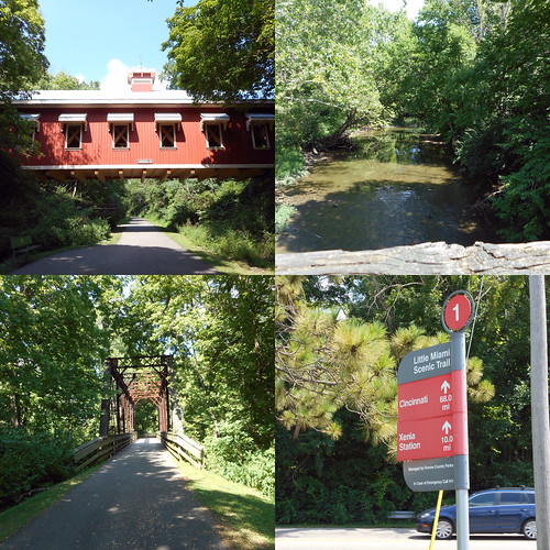
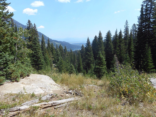
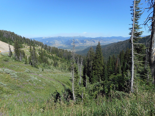
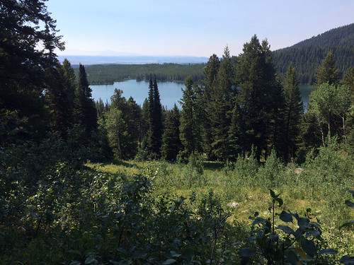
Before we left home both Dad and I had found the Ashton-Tetonia Rail Trail. It was in Idaho and provided views of the "back" of the Tetons! I knew from driving that way to West Yellowstone with Backroads that the views on the Idaho side were pretty nice. This was also going to be a great way to beat the crowds in Grand Teton!

We headed out WY22, up and over Teton Pass! It was an impressive mountain pass! Looked a lot like Colorado with the trees, steep grade and windy turns! There were great views from the top, but the sun was wrong so we'd catch them coming home. We dropped down into VictoR, ID, which is where the Kate's bars Dad and I have discovered are made! We passed through severaL small towns on our way to Tetonia, the southern end of the rail trail.

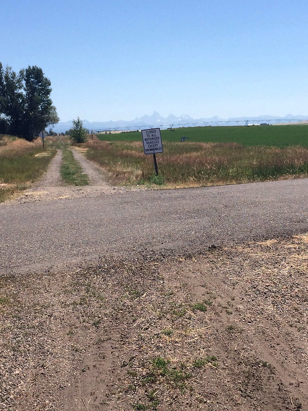
I should mention that we didn't have much guidance in figuring out where the trailheads/road crossings were for this trail. The Trail Link app had a good map, but for some reason I couldn't purchase it. The trail didn't exisit at all on Google Maps. That should have been our first clue.

By linking together the trail end point from Trail Link and Google Maps we were able to find a well marked trailhead with parking and told Mom that's where she was going to meet us. We then continued on down the road to Ashton.

We found a visitor center and picnic area in Ashton, but it was closed and there was no mention of the rail trail in the literature available. We visited the nearby gas station for bathrooms and had lunch at the picnic table, then again used Trail Link and Google Maps to locate the beginning of the trail. There was no parking so Dad just pulled off the road. We got ourselves together and headed out. Mom was going to drive back to Tetonia to meet us.

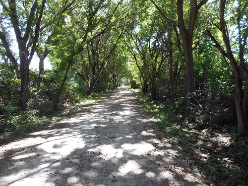
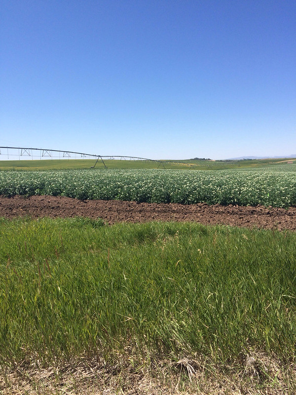
The entire trail is 29 miles long. We'd planned to ride it all. That plan started falling apart for me about 5 miles in. The trail surface was really rough. Soft sand, big rocks, ruts, grass, deep gravel, some smoother sections, but it was slow going. At 5 miles my "map my ride" app informed me I was going 6 mph. So, 30 miles was going to take a lot longer than I'd planned. And, it was blazing hot. There was no shade. The trail was put in farm county - lots of potato fields and other crops we weren't sure about. No trees. No shade. No clouds. Middle of the day crazy hot sun. And I wasn't moving fast enough to get a breeze.


I did kinda get into a groove where I was worrying less about flat tires and riding a bit faster, the trail was more solid. And then came the detour. There was a detour around a section of the railroad that is on private property and we had to go around. The detour included a rutted, soft dirt road that had several huge steep hills (the rail trail stayed fairly flat because trains don't do up and down.). In most places it was too soft for me to ride so I walked. One hill was so steep we couldn't see the bottom from the top! Then we came to the gravel road. This road was better, but the gravel was loose and deep and the hills were steep. I did a lot of walking.

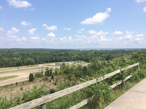
When we finally got back to the rail trail it looked to be in worse shape than when we'd left it. Idaho Route 32 was only a few feet away and looked so smooth and inviting. Never mind that there wasn't much shoulder, it was windy and uphill and the speed limit was 65, we were riding the road.

We'd texted Mom (how in the world we had cell signal out here I'll never know, but we had full signal the whole time) and she had come back up the road and parked in a pull out at Mile Marker 8! We were at mile marker 12! Only 4 more miles! We'd be climbing gently, with small brief downhills since we got on the road, but just after mile 10 was a huge downhill! Ahhhhhh! Followed by a very steep uphill. Ugh. But, as we coasted down the next downhill, I saw the pullout, Mom was waiting at the bottom! 19 miles, over half on the rail trail.

As we drove back toward Jackson Dad and I hatched a plan to ride down from Teton Pass! This morning we'd noticed a bike path at the top and bikers coming up! It reminded us of Vail Pass! We decided this would be our reward for putting up with crazy rail trail ride. When we arrived at the pass we got our bikes and headed down.


The bike path was actually the Old Pass Road and it was seriously steep, with tight hairpin switchbacks! We had to grip the brakes the whole way down. There was no coasting until the last mile. It was on pavement thought, even the part that was on a gravel road was smoother. However, it was not a fun ride down.

We came close to 30 miles on the bike today, but the 7 miles down Teton Pass don't really count since we didn't pedal at all!

After we got the bikes loaded back up we headed to Bon Appe Thai in Jackson where I got some of the best Pad Thai I've ever had! It was all veggie with just enough kick! So yummy! Then of course we had to stop by Moo's for our ice cream fix! I got chocolate chip this time. The other night I got some of Moo's sorbet at Albertson's and I think that's my favorite, it's only strawberries and sugar and has 45 calories per half cup. You could eat the entire pint for less calories than a small serving of ice cream. And it has great strawberry flavor!

Then back to the campground to run our generators!


Saturday, July 23, 2016

Phelps Lake Attempt & Rodeo

Our plan was that Dad and I would ride our bikes to the Laurence S. Rockefeller Preseve - Dad had mapped it as being 21 miles - then Mom would meet us for lunch and a 3 mile walk in the preserve.
The morning was still cool and nice as we headed out of the campground! We zipped right down the Gros Ventre Road to the bike path! The bike path was a nice ride, great views, mostly flat, paved! Once we got to Moose we turned onto the Moose-Wilson Rd, which was narrow and windy, but the speed limit was low and it was shady! Almost immediately we came to a big hill! It was really steep too! I had to go down to 1st gear! But the rest of the ride was downhill. We stopped at Death Canyon Rd and Dad said it was another 6 or 7 miles and we had some more elevation to gain back. As we headed out it was a nice, coast-able, downhill. And then, there was the preserve! Turns out it was only 16 miles.
Laurence Rockefeller, son of John Rockefeller, gave the park his ranch in 2001 so that it could become part of the park. They tore down buildings to return to land to a more natural state. There is a visitor center there, but it was built to be fully green and a very elaborate composting toilet system. The whole place is dedicated to Laurence Rockefeller and you can tell the visitor center and toilet system was very costly to build. Supposedly it's part of the park but it seems very different from the rest of the park and doesn't really fit. It's a nice place, but I don't think it's going to be my favorite place in the park. If it had been me giving my ranch to the park service I would have demanded that they just install some trail heads and let it all be wild, without the glitzy visitor center and constant reminder of who gave it to the park.
Parking is very limited at the preserve. There were about 10 cars waiting for a spot to open up when Mom got there. We waited a little while, but there are no picnic tables to eat on and it was going to take a long time to get a spot. We did learn that this weekend is "Pioneer Days" in Utah and then entire state of Utah gets a 3-day weekend, so there are more people up here than usual. So, we gave up our spot in line and went to an overlook to eat.
From the overlook we could see a creek and it's probably a great place to spot a moose at the right time of day, but not at noon. There were lots of birds and Dad got out his spotting scope and spent nearly an hour looking at stuff.
The next stop was a return visit to the Visitor Center - Dad wanted to look around and Mom hadn't been with us. Then we went over to Dornan's in Moose and walked out a short trail to the river where Mom had heard that there might be hummingbirds. There weren't. Next it was back to the campground so we could run our generators early since we were planning to go to the Rodeo in Jackson tonight.
We had a great dinner at the Merry Piglets in Jackson, checked out 2 nature photography galleries and headed over to the rodeo arena.
The rodeo was really fun! I'd never been to one before and this was the real deal! They did a lot of "bucking" events where a cowboy rides bull or bucking horse and tries to stay on. They also had some roping events where a team of two tries to rope a calf around the horns and around one leg. Seemed like more of the Cowboys weren't able to accomplish the task than were so it was an excersise in accepting failure and figuring out how do better next time.

In the middle they he the "Sheep Scramble". This is where they invite all the kids 12 under into the arena, they then release 3 sheep, two with bandanas, one without. Whichever kids get the bandanas win. There's no way that could end badly. None at all. LOL. There were a lot of kids down there - more than 100 for sure, maybe more, some were so little they could barely walk! No one got hurt and they all seemed to have fun!
They also had kids competing in the bucking events! Tiny little kids, under six, getting on sheep and getting thrown off! The kids also did the bull riding, but those Bulls were pretty little and very tame! The kids had to wear helmets, but the adult didn't!
It was definitely a fun way to spend the evening!

Friday, July 22, 2016

Whitewater Rafting on the Snake River

Today's plan was to go whitewater rafting on the Snake River! We'd signed up for the 12:45 trip so we had a nice low key morning. I read a lot of my book and then went into Jackson a bit early so I could get diesel and propane. Although I wasn't able to get the propane until after the trip.

I met Mom and Dad at The Bunnery for an early lunch/brunch! The Bunnery is a great local breakfast and lunch place with yummy omelets and baked goods!

After lunch we made our way over to Dave Hansen Whitewater to wait for our trip to depart! Promptly at 12:45 we boarded a school bus to get to the put in spot. Being on the school bus brought back flashbacks of school and constantly reminding kids to behave. Luckily all the adults followed the rules and I didn't need to use my teacher voice!

Once we got to the put in spot we met our guide Sandy (who was awesome! So passionate about rafting and really had fun taking us down the river!) and got our PFDs, paddles and piled into the boat! The river was seemingly gentle in many places, but the rapids were fun! They were class I & II so not very big, but big enough!

My favorite part of the trip was when the guide let us get out and swim! There were a few others from the boat who got in, but mostly it was the kids! The water was cold and it was moving a lot faster than I thought it was! It looked calm on the surface but it was moving fast! I was just floating along and the current was carrying me down the river! I did get a bit far from the boat and the guide wanted me closer and I tried to swim upstream and I couldn't get anywhere! I was barely even able to stay in one spot! Soon we were getting past the swimming spot and I had to get back in the boat! That was harder than it looked! Dad pulled me up by the straps on the PFD and it was hard getting up high enough to get my leg over the side of the boat! But I made it back in, ready for the last rapids!

Soon we were at the take out! I kinda wanted to jump in again, but with the fast current I didn't dare! Then it was up the hill to the bus and back to Jackson.

The ironic thing about the rafting trip - it's been hot and sunny in Jackson the last two days, it was hot and sunny when we left Jackson and when we returned. But when we were on hand river....clouds. Seriously?

After rafting we visited Lucky's, a local grocery store that features lots of whole foods. Then I got propane. The guy who filled it was the 1st who'd asked me to turn off the propane! I'd turned off the fridge, as I always do prior to filling up with diesel also. So, I'd thought I'd turned everything off, but I was happy to shut off the main propane shut off. It was later that I realized the hot water heater is running on propane and I haven't shut it off since I left home! So much for being "safe" and turning off all propane devices before refueling! Doh! I guess I should flip the main shut off switch before refueling to ensure that everything is off.

After the errands, it was back to the campground for dinner!

Oh, they did open 191/189 today at Noon. That's the road we wanted to take from Pinedale that was closed. They closed it Sunday afternoon and it didn't re-open until Friday at Noon. So glad we went around.


Thursday, July 21, 2016

Taggart & Bradley Lakes Hike

Hiking in the Tetons is interesting, the hikes are all really long backpacking trips or super short strolls. We found one that looked pretty good - we combined two hikes to make one 6 mile hike.

On our way to the trailhead we stopped at the Moose Visitor Center so I could get my passport stamped and get one for Mom. It's a very nice visitor center, but we didn't take much time to look around, the trail we were headed to is very popular and we wanted to get a parking spot!

There were already many cars in the lot when we got there, and a line at the outhouse! A Ranger led hike had just departed, so we headed around the other way.

The trail was very nice, rolling, with ups and downs, none very steep or long. We had some views of the mountains, mostly framed with trees!

Taggart Lake was really nice! The sun was hitting the mountain and making a perfect reflection on the lake! We continued around the edge of the lake and up to Bradley Lakr. This section had a bit more up, but it was still pretty gentle. As we climbed we got views of Taggart Lake.


Bradley Lake was a smaller lake but it was closer to the mountains so the view was slightly different! We had lunch on the rocks by the lake and I put my feet in - it was cold, but not as cold as Cathedral Lake! There were people swimming in it and expressing how cold it was!

The hike back was mostly down, but it was more exposed, and since it was now 1:00, the sun was intense and it was hot! Part of the trail went through a burn scar from 20 years ago, and there were no tall trees, which made for great views, even though it was hot!


The wind shifted while we were eating lunch and smoke started blowing in, creating a haze. Interestingly, the wind shifted again and by 4:00 there was no smoke in the valley! Oh, and the road we wanted to take from Pinedale on Sunday....*still* closed! So glad we drove around!

It was 2:00 when we got back from the hike, so we got Mom (who is feeling a lot better!) and went into Jackson. We ran some errands, got ice cream (I had strawberry this time and I liked it better than the huckleberry!). Then we secured our spots on a whitewater raft trip for tomorrow!

After dinner Dad and I went back up to North Jenny Lake area to hike to Leigh Lake. This was an easy, mostly flat hike, and we thought it might provide us an opportunity to see some moose and other big wildlife. We'd also seen something about the top 6 Nationak Park Beaches to visit, and Leigh Lake was mentioned. What? Beach? In Wyoming?

It was definitely a flat hike, and there were several beaches along String Lake. Leigh Lake was harder to get to - further from the parking area! We only looked at it, didn't go around it. But, when combined with visiting Taggart, Bradley, and String, we visited 4 glacial lakes today!


The only big wildlife we saw were a few deer, but we did get to see the setting sun hitting the Catherdral Group again, this time with the lake in the foreground and the reflection!