Sunday, February 28, 2016

Snowshoeing & Camping in Canaan Valley, WV

Back in January, after the big east coast blizzard I went out to Whitegrass in Canaan Valley to snowshoe. It was so fun I knew I wanted to go back this winter. I'd been hoping for a weekend when I could take the RV and camp. We have Tuesday off from school because of the Presidential Primary so I figured that was *almost* a 3-day weekend and I could devote both Saturday and Sunday to playing! And, the weather looked good - Sat was supposed to be in the 40s and Sunday in the 50s with a low in the 20s.

I got the RV Friday evening, got it all loaded up and was ready to head out at 7 on Saturday morning. Thanks to the new and improved US48 I was able to get to Davis, WV before 10am!

The first thing I noticed was that there was fresh snow! All the roads were covered with packed snow and ice! I didn't look like they'd been plowed! The other thing I noticed was the temperature - it was about 24*-28*. I was a little nervous about driving on the snow. I'd only driven the RV on snow one other time and twice it got stuck on a little bit of ice! Today however, the RV had no issues! Up hill, down hill, through a few inches of slush, through a few inches of snow, over ice - she handled it all with no issues!

My first item of business was to secure a campsite at Canaan Valley State Park. I was really impressed with the new lodge that had been built since my last visit in 2008/09 (I was there over New Year's). The lodge now has a large lounge area where you can sit with a book and not be holed up in your room and an improved quick service cafe! Both things I wish they'd had the last time!

I was assigned to site 26 so I went back to the campground to check it out. It was a nice pull through, it had been plowed, however there was a lot of snow I ended up parking in! Now I had to decide what I was going to do next.

I really wanted to snowshoe at Whitegrass but I was worried about parking the van, especially since it was already mid-Morning and likely crowded. I went over there to see what th situation was. I pulled in and there was a nice young man directed traffic and he pointed me to an area that looked more like a ditch with plenty of opportunity to get stuck in either mud or snow than a place to park my RV. I decided to trust the young man and pulled in. It was pretty uneven but I turned off the fridge and got ready to go!

It was 11 and I was ready for lunch, but the cafe doesn't start serving until 11:30 so I went out to stretch my legs! I snowshoed out to a little "snowshoe trail" just inside the Canaan Valley Wildlife Refuge. It was the perfect little teaser for the rest of the day! There was just barely enough snow for the snowshoes. The trails at Whitegrass are groomed for cross country skiing and snowshoers have to stay to the side so we don't tear up the tracks, when there's not much snow this is hard!

After a lunch of yummy vegetarian Whitegrass Chili, I headed out for a longer snowshoe. This is the 3rd time I'd been to Whitegrass and both other times I'd climbed to the top of the mountain, this time I wanted to do something different. I went up 3 Mile, a long steady uphill. This is one one of the more popular ways to the top and there were a lot of skiers! There was also a wide area to the side of the groomed trail with plenty of snow so it was easy to snowshoe. I then went out Blackbird's Wing, which isn't groomed, or very popular, so it was easier to snowshoe. Then I headed down a Forest Service Road to the Timberline Trail. The snow on the Forest Service road was really thin in places and the gravel under was hard to snowshoe on! The Timberline Trail had plenty of muddy spots, but bare ground isn't too hard to navigate on snowshoes. The whole loop was about 4.5 miles! That's going to be one of my favorite routes because it's more remote than some of the other trails.

When I got back to the van it was only 3:00 but I was done snowshoeing. I decided to go explore the towns of Thomas & Davis. Luckily the roads had totally cleared! No evidence at all of the earlier snow! It was still about 28*, though. Thomas has a nice looking Main Street, but there wasn't a whole lot to check out - an art gallery, a general store, a coffee shop. I walked the length of the street and went in a few stores then headed back to Davis. My first stop there was Highland Market. They had prepared foods from Whitegrass Cafe! I picked up some Spanakopita, which was perfect for dinner tonight when I got home! And they sold The Whitegrass Cafe cookbook! Now I can make my own chili and Spanakopita, and more! I was able to leave the van in the market parking lot and walk up to Hellbender's Burritos for dinner!

I'd discovered Hellebender's back in January and couldn't wait yo go back! Their Lost Hiker burrito is seriously good! It's sautéed mushrooms, guacamole, cheddar jack, lettuce and homemade bleu cheese dressing. Odd combo that I never would have put together, but it works! And it's an excellent calorie replacement after a day of snowshoeing. Because Hellbender's is one of the best, and only places, to eat in Davis, I decided that earlier was better and it ended up being 4:15 when I got there! They were almost full and I was one of the oldest people there! Usually it's the old folks eating that early! I suppose there's a chance that the "kids" were eating a late lunch rather than dinner!

After dinner I headed back to the campground so I could get hooked up before dark. I had about 30 minutes of daylight left so I walked the campground, I was surprised by how many sites were occupied, most with tent campers! It was still in the 20s, had been all day! What happened to the highs in the 40s?

I spent the evening curled up with my book and my ceramic heater. The ceramic heater took the edge off the cold, but my hands were still freezing, which made reading hard! I was tired from being up early and snowshoeing all day, so a little before 9, I turned off the ceramic heater and crawled into my nest of sleeping bags and quickly fell asleep.

That sleep didn't last long. A little before 10 I found myself sitting up in bed, wide awake, with the lights on and the CO/LP alarm blaring. Ugh. The alarm shut itself off before I could even get the door open. I was pretty sure it was a false alarm, I hadn't used any propane appliances at all. I tried to go back to sleep. I was almost asleep when it went off again. Seriously!?!? This time I left the window on the sliding door open. 26* and I'm sleeping with the window open. I'd just dozed off again when the sounded a 3rd time. REALLY?!?? Seriously!??! Ugh. This time it took longer for it to shut itself off. I was debating what to do, and was considering driving home. It's a 3 hour drive - so it would be 2am or later before I got home, with the potential for ice on the roads, the RV has a headlight out. This wasn't a good plan. Then it occurred to me that the alarm won't go off if I disconnect the battery! So I went out unhooked the electric, turned off the propane, then disconnected the battery. I did open the window by my head, just in case it wasn't entirely a false alarm, and went to sleep.

(Just a note to other RVers - this was not the safest move and normally I wouldn't recommend it. My LP/CO detector has false alarmed 8 times prior to this over the course of the 4 years I've had it. Propane has a foul odor and if it was leaking in the van I would have smelled it. CO only forms when gas isn't fully combusted. I hadn't used any propane appliances my whole trip. No propane being used, no chance of CO forming. Therefore the logical conclusion in this case was false alarm.)

After the alarm stopped going off I slept great! Didn't wake up until 7! Which is crazy late for me! My feet got really cold, but otherwise I stayed pretty warm! Of course the first thing I had to do was go out and reconnect the electric and turn the propane on so I could make coffee!

I decided that this morning I'd check out the trails in the state park. I'd hoped to snowshoe but I decided that there wasn't enough snow so just walked. I was impressed by the trail network in the park! When I was here in 2008/09 I walked a few of the trails, but it was snowing heavily with a 50 mph wind, hard to really appreciate the trail in those conditions! I'm not sure how far I walked, but I was out about 3 hours, so it was probably close to 6 miles. It was really sunny and warm and a lovely day for a hike. It was a great call to leave the snowshoes, the snow was thin and as the temperature went up it was melting fast!

Next, I headed over to Big John's Family Fixins, for pizza before I left! I ordered a bigger pizza than I would eat so I'd have leftovers to take for lunch tomorrow! After lunch it was time to head home! It was sunny and warm and I had the window down the whole way! I stopped in Frony Royal for fuel - Diesel was $1.77! I filled up the RV for $33! What!?!? Hopefully fuel stays cheap! I got home by 4 and took care of the bare minimum unloaded and made a quick Giant run. Regular school day tomorrow and then I'll catch up on Tuesday! It was great weekend and totally worth not exactly being ready for tomorrow!

Sunday, December 27, 2015

Beach Adventures

It's been a freakishly warm December here on the East Coast and with the summer-like temperatures coming right in the middle of winter break, I knew I had to take advantage! There were a few warm days before Christmas, but the warm weather came with pouring rain so it wasn't good camping weather. After Christmas it looked like the warmth would continue AND the rain was going to stop!

One of the challenges of winter camping is finding open campgrounds. I knew the campground at Assateague Island National Seashore was open year round and the beach is somewhat on the way home from my parents house in Williamsburg.

The Fog

We'd had a nice family Christmas with bike rides, Scattergories, fettuccine, and way too much fudge!

When I left about 2:00pm on Saturday it was misty and cloudy, but the temp was in the 60s. As I got closer to the coast the fog got thicker and thicker!

Just before the Hampton Roads Bridge Tunnel I experienced my first inspection station for my propane tank! The fog was thick going across the bridge that I could hardly see the water! There were a few hardy fishermen out there though!

The Cheasapeake Bay Bridge Tunnel was more of the same, fog as far as they eye can see - which wasn't far! This time however, no one inspected my rig to ensure that the propane was off, they just collected $13 and let me drive across. The Cheasapeake Bay Bridge Tunnel is neat because it's almost 18 miles across! It reminded me of the Overseas Highway in the Keys. There's even an island in the middle with a rest stop, gift shop and a resteraunt!

On the other side of the bay the road went further inland and the fog lifted! It was just cloudy and occasionally drizzly!

The Long Dark Night

Another challenge of winter camping, particularly in mid-December is how to deal with the long night. Sunset of Saturday was at 4:45 and sunrise Sunday was at 7:15 so 14.5 hours of dark!

Since I didn't leave until 2 I was going to spend at least the first hour of dark driving. This is good and bad. It meant less time to occupy myself in the campground, but I'm not a huge fan of driving at night and I really don't like coming into a campground after dark. I'd been to Assateague before so I kinda knew where things were and I was glad because it was really dark out there. The fog/mist and the clouds blocked out the full moon and there was no artificial light.

The park and the campgrounds were pretty much deserted! I saw 5 other campsites occupied! I found a site in the Oceanside campground that was right by the path over the dunes to the ocean! It was a big wide site with no trees or other obstacles, I was able to back in and get the RV perfectly in the site on the first try!

It was so dark and dreary it felt like it was midnight, but it was only 6:00! I started the generator and heated up dinner. I opened the windows and once I turned off the generator I could hear the ocean crashing right outside! After dinner I'd thought I'd go for a walk in the campground.

I grabbed my raincoat and headlamp and headed out. It didn't last long. The mist was so thick I couldn't see anything and the headlamp made it worse. I walked about 5 feet from the van and decided that I'd just go back in and read.

I was reading Pretty Baby by Mary Kubica - it's a psychological thriller and it was very good and not really scary, but reading the last 100 pages sitting in a deserted campground on a very dark and rainy night was a bit creepy! Luckily I had Becoming Chloe by Catherine Ryan Hyde with was more warm and fuzzy, to start when I finished Pretty Baby.

About 10 I decided it was time to go to sleep. I slept great. I had the window open and there was a chilly breeze - it was in the 50s all night - but I was in my sleeping bag. I woke up at 6 and it was still dark.

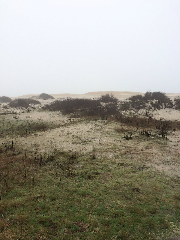
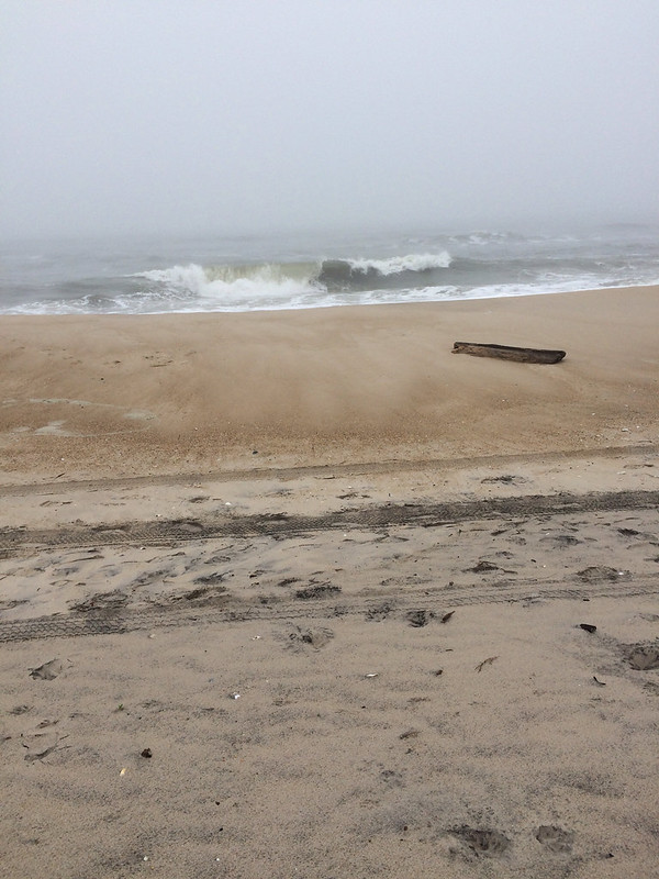
View from my campsite, if it wasn't foggy I would have had an ocean view.

I made the coffee and got dressed and settled in to read some more. Soon the sky was getting lighter and the sun was up! The fog however hadn't budged. If anything, it was thicker!

As soon as it was good and light out, I went for a walk around the campground and out to the ocean. It was too cold for wading, but otherwise pleasant, even if I couldn't see anything.


The Sun Comes Out

It was mid-morning when I started up the road to Cape Henlopen State Park. I drove up Route 1 to Ocean City and then up through the other Delware beaches. It took about an hour and a half and slowly the clouds lifted and the sun came out! By the time I got to Cape Henlopen the only clouds were high and thin! The sky was blue and the sun was shining! It was also quickly warming up!

I changed into bike shorts and a t-shirt and took off on my bike! I had no plan, no map, I just followed the bike path.

Cape Henlopen is a great place to ride your bike! They have several scenic bike paths - paved, crushed cinder, and totally off road - that can be linked together to get a good length.

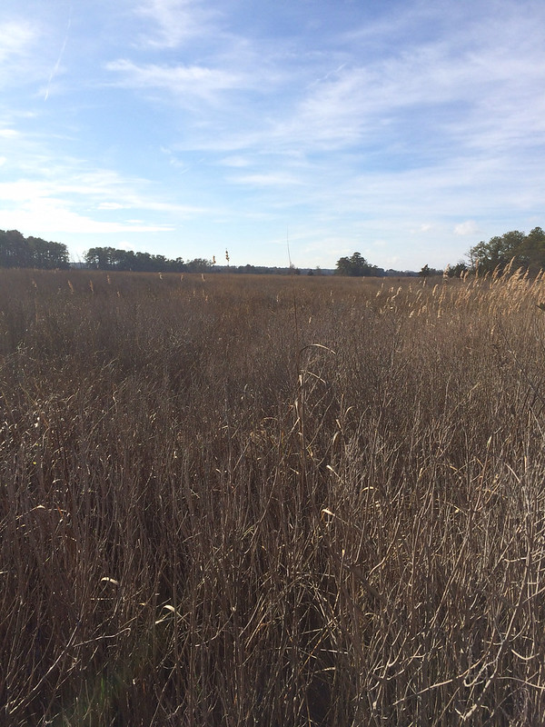
I started on the paved Bike Loop and rode it around to the main beach area. I walked up to the beach but didn't go out on the sand (I'd had enough sand this morning!). Then I had to ride on the park road a bit to get to "The Point". I could have walked further out, but that would have meant walking on the sand, which I didn't want to do. I went back to the bike loop and continued around to the campground. I took a detour into the campground to check it out. After the campground I headed out the Salt Marsh Spur. This path was off road, but it was still smooth and easy to bike. That brought me to the Gordon Pond Loop. This part was the best part! It was wide crushed cinder and wound through the marshy area! It was 3 miles down to another parking lot, then you had to ride back! When I got back to the van it was earlier than I'd planned to leave so I rode the paved bike loop (3.3 miles) again! All told it was 16.99 miles! Should have ridden a few more feet to get an even 17, but my GPS is on my phone and it's in my backpack so I don't see it until I'm done.


It was 3 hours home and I'd wanted to get to the Bay Bridge before dark. The route before the bridge is a lot of country roads and it would be easy to get lost, but after the bridge it's just US 50 to the beltway, I've driven it bunches of times and don't mind driving it after dark.

I left Cape Henlopen at 2:30 and crossed the bridge with the sun low in the sky! I made it almost to the beltway before it was good and dark. It was stil 70* when I got home so I was able to unload the van while it was still warm! It's supposed to get cold tomorrow!


Sunday, October 11, 2015

C&O Canal Towpath

It had been two months since I'd driven the RV, we had a long weekend for Columbus Day, and the weather was gorgeous. Time for a field trip! I was driving the RV so I decided it would be a biking trip - I still don't have a bike rack for my SUV! Since I didn't make reservations anywhere I figured a day trip would have to do, I didn't really want to stay at a Wal-Mart. I loaded up the RV with just what I needed for the day and headed out to Hancock, MD to hopefully complete another section of the C&O Canal Towpath.

Last year, over Columbus Day I went to Williamsport, MD and rode a section of the towpath, but I could not remember where I'd turned around. Couldn't remember the milepost, a landmark, or even how far I'd ridden! I figured I'd prob gone 10 miles from Williamsport, so it looked like I could do a 30 mile round trip ride and complete the section from Williamsport to Hancock.

I headed out 66 to 81 to 70 and it was taking a long time. It was already almost noon and Hancock was still 20 miles away. I was ready to stop driving and start riding when I saw a sign on the highway for the C&O Canal Towpath: Four Locks and McCoy's Ferry. Good enough! I was heading there and I'd ride whatever section was there. Trying to be less OCD about riding the entire towpath and just enjoy a fabulous fall day!

I got off the highway and into the farmland of Western Maryland! At first the road was wide and nice! Double yellow line! I was following the signs and each road I turned onto got smaller and less well maintained! I had no idea where I was and I didn't even have a good map! I had my phone, only good as long as I have cell signal.

Soon I passed a the turn off to Four Locks and down the road I could have turned onto had a tunnel sign. That sign triggered the memory of where I'd turned around last year! I was at a snap NPS car camping campground that would be perfect for Roxy, but in order to get into it you had to go under the towpath and the tunnel was low, I wasn't sure if Roxy would make it. I was suddenly wondering where that campground was...today was the perfect time to find it and see if Roxy would fit. Maybe on the way back I'd explore. There was no way to turn around and get back to the Four Locks Rd so I kept heading to McCoy's Ferry.

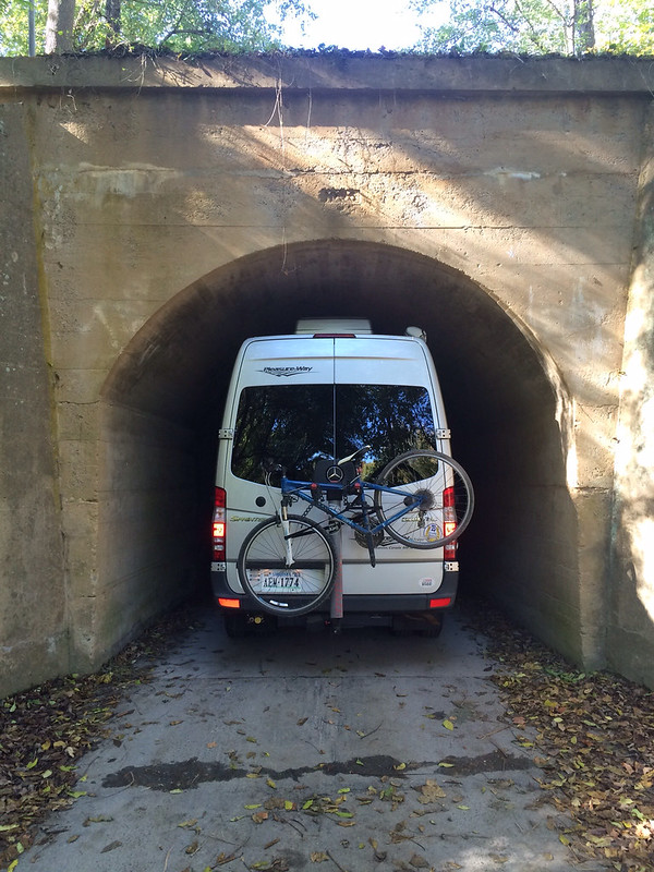
Eventually the road narrowed to one land, then a dirt road went off to the right with a NPS sign. I'd missed going on the dirt road so I went up & turned around in a school bus turn around. Then I had to make the obtuse turn to get on the road to McCoy's Ferry. I managed to do a 4 point turn without too much drama - scraped the running board & thought I was stuck in loose gravel but no lasting marks. Then I saw the tunnel sign. Clearance 10 ft 3inches. Hmmm... I'm pretty sure I'm under 10ft....

I pulled up to the tunnel and attempted to look and see if the AC unit on top would clear, but I couldn't see. So I decided to put the window down, turn the radio off, and drive slow. I figured I'd know real fast if I didn't fit. I didn't hear any scraping! I fit!


And when I emerged on the other side of the tunnel, I was in the campground I'd turned around at last year! The exact spot! Without even trying! And, I'd learned that Roxy can get in!

The campground had only a few people in it. If I'd been prepared I could have had a prime spot right on the Potomac! But, now I know for next time. I found place to park in the day use ares and got the generator going to heat lunch in the microwave. While I was waiting I pulled out the owner's manual to find out the official height of the RV - which I probably should have done *before* I went through the tunnel. The RV is 9 ft 6 inches. The tunnel was 10 ft 3 in so I had a mere 7 inches of clearance!

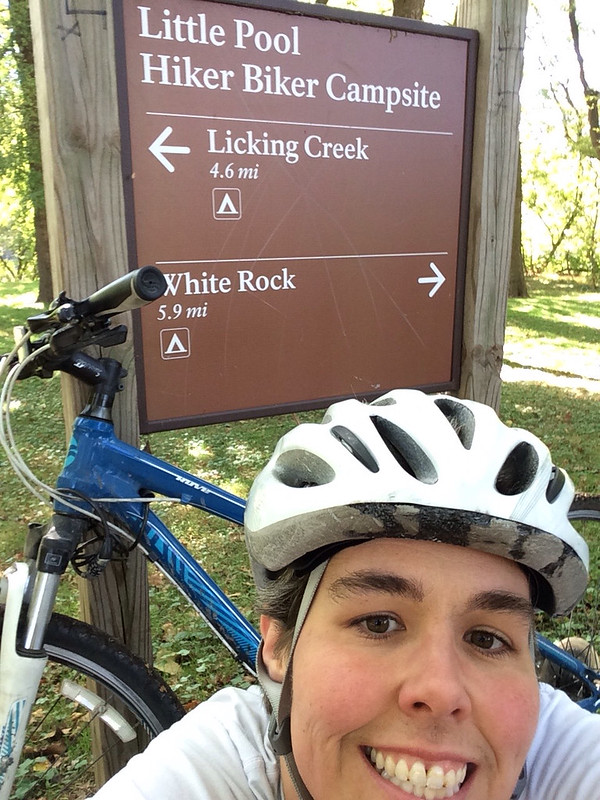
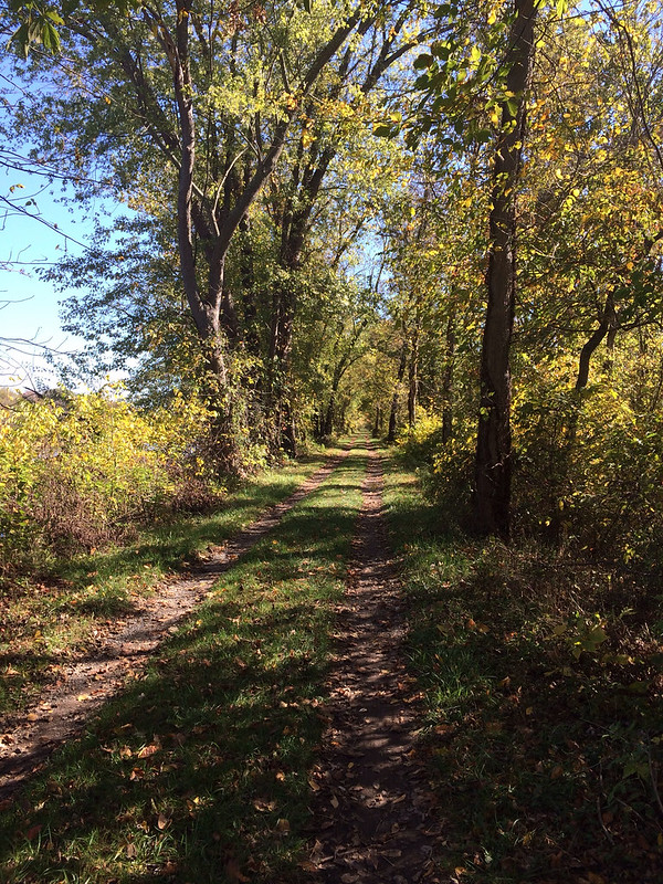
After lunch I took off down the towpath! It was already 1:00 and I still needed to drive home so I decided to only do 20 mile RT rather than going all the way to Hancock. I was about 4 miles down the trail when I saw a sign for the Western Maryland Rail Trail. I wasn't familiar with the rail trail so I made a mental note to look it up when I got home and continued. The crazy thing about the towpath is that it all looks the same, yet it's all different. Soon I'd reached the 120 mile marker and was going to turn around at the hike/bike in campsite right past it. Just before the campground there was a bridge that looked like it connected to another bike trail. I wondered if it was the rail trail? I rode down to the campsite, took a selfie with the sign so I won't forget where I turned around and went back to the bridge.


Sure enough the bridge lead to the Western Maryland Rail Trail! Turns out it's a paved bike trail that runs parallel to the towpath 22 miles from Ft. Frederick State Park to Sideling Hill Creek Aqueduct. So this whole section you can do loops! Ride one way on the towpath and back on the rail trail! How cool! I decided to ride back to where the rail trail had joined the towpath. It was really nice because the rail trail is paved and smooth and I could go faster! (The towpath is not paved) The other fun thing about the rail trail was that is parallel to I70. The same I70 that goes over Vail Pass in CO. I tried to pretend I was riding up Vail Pass, but Western Maryland just isn't the same.

When I got back to the towpath I had 4 miles to go to get back to the campground! It was going to end up being close to 25 miles! I was glad I hadn't gone for 30 miles. Both bike paths are flat, which sounds like a good thing, but it means you have to pedal the whole time! No downhill breaks! My thighs were screaming!

Back at the van I quickly got ready to drive home, it was 4:00 and would take me at least 2 hours to get home. I did take the scenic route and not the interstate which made for an enjoyable evening driving through the mountains!


Monday, August 10, 2015

Pictures Slideshow

Just the pictures....for anyone who just wants to see pictures from the trip, click here!  Beware, there are over 600, but it shows almost everything.
Summer 2015

Saturday, August 8, 2015

Home

After 6 weeks, 44 nights, 21 states, and 7600 miles driven, I am now home in Northern Virginia! I drove from home to the Pacific Ocean and back!

I didn't write a blog post yesterday because all I did was drive. I did finish listening to The Supremes at Earl's All-You-Can-Eat. I ended up really enjoying it! The narrators did a great job capturing the characters personalities!

Another way I entertained myself while driving was to play the liscene plate game. I have a notepad shaped like the 48 contiguous states and it has the states outlined on it. I tape a page of it to the steering wheel (over the horn) and then just marked each state off when I see it. I'm good at geography so I can check off a state and barely look away from the road. Prior to leaving Sisters I'd seen every state (including Alaska and Hawaii) except Delaware. I decided to start over for the trip home. Between Sister's and home I saw every state except North Dakota, Vermont, and Rhode Island (again, including AK & HI!). I saw my first/only Delaware plate near Steeles Tavern, VA on I-81! I was about 150 miles away from not seeing a single DE plate! There were three vehicles from Delaware right together!

Tomorrow I'm going to work on updating my "States Visited" page and putting in links for all the State & National Parks. I'll also post a slide show/photo album with all my pics, but for now I need to go change the laundry...again...so much laundry when you get home!

Thursday, August 6, 2015

Shorter Drive

I had fewer miles planned today, a little break after a big driving day because the mileage didn't work out evenly! This allowed me to have a few hours to check out The Brown vs. Board of Education National Historic Site in Topeka, KS!

The Brown vs Board of Education site was very interesting! It was all about the end of segregation and equality for all. It was interesting to see the same themes as I'd noticed back in South Dakota with the Native People and we white folks marginalized them and took their land. We did similar things to the African Americans too. Makes me wonder what exactly our founding fathers meant by "all men are created equal". I'm glad for the folks who fought for civil rights!

It was noon before I left Topeka so I was glad I only had about 200 more miles to drive! I'd planned to stop at Graham Caves State Park, about 80 miles west of St. Louis. There weren't many camping options until well after St. Louis and I didn't want to do a Wal-Mart in St. Louis. (Remember the Griswalds, they got their hubcabs lifted in St. Louis! LOL!)

I arrived at Graham Caves a little after 4 and went to the campground. The first thing I noticed was that the campground was really far from the rest of the park and despite it seeming like Missouri is flat from the highway, in the park there were huge steep hills (steeper than Vail Pass!) so biking would have been hard. The next thing I noticed was that the campground was empty. There was a camp host and one other site occupied. I didn't like the way that felt so decided to check out the rest of the park then head to the commercial campground that was on the road in.

The rest of the park was just as empty as the campground and there wasn't much to see. There was a trail that went to the cave, but I decided not to hike it. I think it was just a cave to look at, not to go in.

I drove out and got a site a the Kamp Kan-Do Kampground. The misuse of the K rather than the C almost made me look elsewhere, but I didn't. It's an odd little campground, more seasonal residents than folks passing through but it's safe and seems quiet so it will do just fine for one night!

I ate my "long underwear" baked potato tonight...it was very good! The long johns worked just as good as foil!


Wednesday, August 5, 2015

Contrast

Today started here:


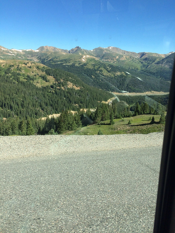
Loveland Pass, almost 12,000 feet.

And ended here:


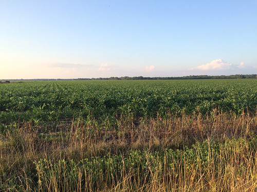
Salina, KS - this view is what most of Kansas looks like!

All I did today was drive! I chose to drive over Loveland Pass rather than take I70 through the Eisenhower Tunnel because I wanted to see more of Colorado before I hit Kansas! It was 6 miles up with 3000 feet of elevation gain, and 4 miles down, although once I got on 70 I was still going down for probably 15-20 more miles.

Once I got to Denver I was past the mountains and the flat farm county started. The eastern half of Colorado is exceptionally boring, but once you get into Kansas the scenery improves a bit. It's still flat and open with some rolling hills but it's more farms and there are even some trees!

I actually don't mind Kansas much, I think it's better than Nebraska, South Dakota and Montana! The first time I drove through Kansas I thought it was very remote and that there was nothing here, now after having been places where there is actually nothing Kansas seems very populated! There's fuel and resteraunts and stuff at almost every exit!

The big thing today was keeping myself entertained while I drove! I'm listening to another book, The Supremes at Earl's All-You-Can-Eat by Edward Kelsey Moore. It's a good light read, I still don't really like listening vs reading, but it does help the miles go by. I can only listen to the book for a few hours at a time and today I finally let myself listen to Pandora. I have a "favorite bands" channel that I've created and I love it, but it uses data, I'm not sure how much, I hope it's not much because I really enjoyed listening to Pandora today!

I was going to stay at the Wal-Mart in Salina but I drove down there - it was 4 miles off route - and it didn't look good, looked noisy and at 6:00pm there weren't any other RVs there, so I drove back to 70 and went to the KOA. I have a nice site with electricity and cable! I've never hooked up to cable, I have a very short coax cord that usually doesn't reach, but here it does! I haven't watched TV since I left home so it was exciting to watch Modern Family over dinner and Big Bang Theory while I'm blogging! I also met some nice folks from Louisana parked next to me. And, I cooked my baked potato so it would be ready when I'm ready for dinner tomorrow. The directions yo cook a baked potato in my convection oven were to use the "compucook" feature and then wrap the potato in foil for 15 minutes. I don't have any foil, but I figured it needed to insulated and keep the heat in while it finishes cooking, so I wrapped it in my long underwear...here's hoping it works!