On Sunday when we arrived in the Columbia River Gorge I wasn't so sure I'd like it. After the hot barren nothingness of the river back in Washington and then all the people, it just didn't seem like a place where I'd find much I'd like. Well, I was wrong!
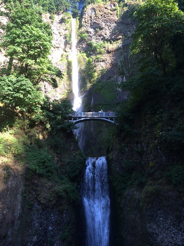
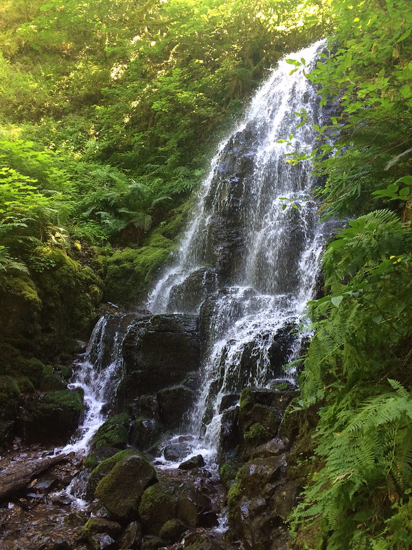
Today Dad and went back to Multnomah Falls area and hiked up to the top and beyond! We had a rough map if the tracks in the area and there was a loop that took us up one canyon, across the top and down another canyon. The creek along the canyon had waterfalls and cascades and there were big moss covered trees and it was nice and cool! We went past two waterfalls on the way up - Weisendanger and Ecola.
After we crossed the top, as we were about to go down, we saw a side trail that went up to Devil's Rest overlook. It was 1.6 miles up and about a 1000 ft of elevation gain - we debated skipping it, but decided to go for it! It was very steep at first, but soon it leveled out! The trail was wide and smooth and had pine needles all over it making it very easy to walk. As we climbed the views got better! We could see Mt. St. Helen's and what we think is Mt. Rainier (turns out, it's Mt. Adams). As we climbed I had grand visions of what we would be able to see from the top - in addition to Mt. St. Helens and Mt. Rainier Mt. Adams I figured we'd be able to see Mt. Hood, Portland and maybe even The Pacific Ocean! I had my sights set very high!
Right about where we thought the viewpoint should be we saw a trail sign, that looked handwritten - not a standard issues USFS sign, saying that the trail went to Angel's Rest - we didn't think the trail went past Devil's Rest because on our map the trail ended. Hmmm... We figured we must be at the end of the trail so started looking for the viewpoint. We ventured down several rogue trails, but all we could see was trees. No view at all. We even headed in the direction of Angel's Rest thinking maybe the view was down there...nothing. So eventually we just headed back, thinking we'd stop at the rock where we'd stopped on the way up.
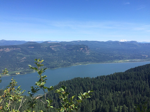
Mt. St. Helens is on the left, it's hard to see, Mt. Adams is the big one on the right.
We were almost to the rock when I spotted another rogue trail that looked like it was heading toward an overlook. We walked down it and came to a small rock outcropping that had a great view of the gorge, the river, Mt. St. Helens and Mt. Rainier (?) Mt. Adams. Not sure it was officially "Devil's Rest" or not, but we are calling it Devil's Rest! We sat and ate lunch and discussed whether the big mountain was Rainier or Adams, we finally decided that it must be Rainier (we were wrong!) before heading down!
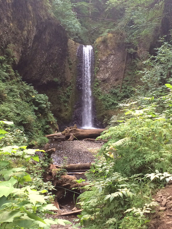
Almost 4 miles of hiking up means you have to hike down 4 miles. Ugh. The first part of the hike down was nice as we were high enough to have a view. As we got lower the view went away and it wasn't as interesting. Eventually we got back into a canyon with a creek and we saw Fairy Falls, then the creek continued to cascade it's way down and the trail ran right next to it.
Soon though the trail turned off and had many switchbacks bringing it down and it wasn't very interesting until we reached Wahkeena Falls! I think Wahkeena might be more impressive than Multnomah! And there were fewer people!
After that there was a 1/2 mile trail that paralleled the road and took us back to Multnomah Falls and the car, but not until we indulged in a treat at the snack bar!
After the hike we came back to the campground and spent the rest of the day just hanging out! We almost never do that and it was nice! It wasn't quite so hot, and by evening it was very pleasant outside. I got my blog done, did some internet stuff and even started a new book!
No comments:
Post a Comment