I'd seen several pictures of Oneonta Gorge on Pinterest and thought it looked like a cool place, the hike to it was right by our campground and the trail came back to the campground so we could do it as a one way hike.
We started about 8 am, before it got hot and before the people came out! Mom drove us to one end of the trail and we started walking! We'd thought maybe it would be mostly up, but it was a good mix of up and down.
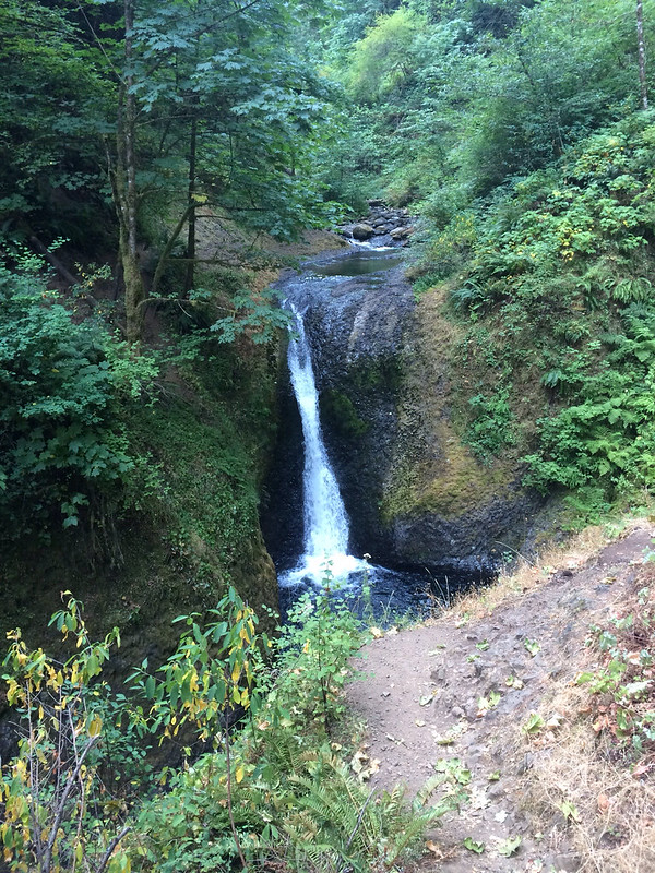
Oneonta Falls was not what it looked like in the pictures I'd seen! I think those pictures had been taken from off the official trail and it was very steep getting down to where I thought they'd been taken. It was a bit disappointing.
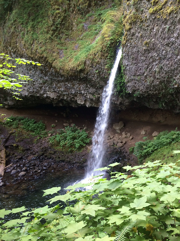
I thought Oneonta was the only waterfall on this hike. I was wrong. This hike also went past Ponytail Falls - which is the upper part of Horsetail Falls. This waterfall was very cool! The trail went right behind it and there was a swimming hole under it! I imagine the pool was full of people later in the day!
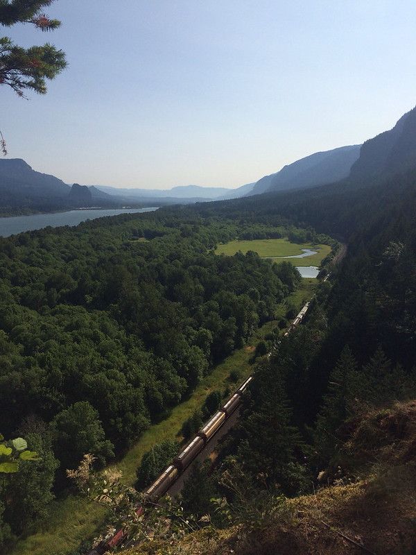
There was also a nice overlook where we could look east and see most of the gorge!
After the overlook and Ponytail falls the trail was supposed to take us back to the campground. When we crossed from National Forest Service land to the State Park land there were huge signs indicating which direction we should go. So when we came to an unmarked trail I figured we didn't need to go down there. But then we thought we saw the campground through the trees and Dad's GPS indicated that maybe the unmarked trail was what we wanted. So we turned around and walked back to the unmarked trail. We walked down it a little way and it looked like it was heading for the road, so we turned around and walked back uphill to main trail. We continued down the main trail until we did come to a sign and side trail. This side trail was clearly marked with campground .2! Only problem was we came out in the campground at the opposite end from where we wanted to. What? Turns out the 1st side trail we were on was what we'd wanted, if we'd kept going another little bit it would have taken us to the campground. So annoying to get so "lost" so close to the campground! I guess that's what happens when you don't have a proper map (only map we have is a rough sketch and doesn't include all the trails). Someone needs to come up with a map/guide book rental service!
This hike ended up being very short and we were back at the campground by 10:30! We had lunch and finalized plans for our trip down the coast next week, then headed out to check out the rest of Gorge along Historic US30. We went to Bridal Veil State Park, Vista House, and Lewis and Clark State Park.
Bridal Veil State Park was nice. It has two trails - one a loop with views of the gorge and another up to Bridal Veil Falls. Dad went to the falls and Mom and I did the loop with the views.
Vista House was kind of neat - we learned all about the history of the road through the gorge and it has some nice views. And we talked to an Oregon State Parks Ranger who told us that the mountain we saw yesterday was Mt. Adams, not Mt. Rainier.
Lewis and Clark State Park was quite a disappointment. It was basically a big field with a "nature trail" around it with some info boards about Lewis and Clark. Lewis and Clark seem so important to Oregon History it seems odd that the park is so meager.
Tomorrow we are heading to Portland! Going to see my friend Bill from Westminster and my friend Emily, who I've known since before Kindergarten! I also have plans to visit Voodoo Doughnuts and Powell's Books!
No comments:
Post a Comment