Turned out to be a very quiet night in the creepy Kmart parking lot! The store closed, it was well lit and no one came through! This morning we went to the grocery store, that was right in the parking lot with Kmart, the headed to Redding.
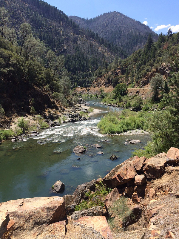
We went east on CA299. It was a "scenic" route that lived up to its label! We climbed many mountains and went along the Trinity River for a long time! The road passed through Six Rivers National Forest and Trinity-Shasta National Forest. I tried to take pictures while I drove but that's hard on a good day and even harder when I'm trying to negotiate curves!
We stopped for lunch at a pullout where we could see rafters heading down the river!
The final decent into Redding was crazy! The road just went back and forth like they'd added extra curves just for kicks! It was nearly impossible to get the van into a gear that would allow me to cruise and not be applying the brakes all the the time! 3rd I'd get going too fast and 2nd I had to cut my speed down too much. They are doing a major reconstruction of the road here to straighten it out, I see why! Sunday is the only day they don't work and you can drive without the 1-2 *hour* delays! Glad we timed that right!
Just after the big descent we came to Whiskeytown Lake and National Recrecation Area. It's a huge lake with swimming and boating and camping. I stopped at the visitor center and was able to get information about Lassen.
We arrived at our campground and Dad and I were going to go ride some of the bike paths in Redding. Only catch, it was 100 degrees! We came over the mountains, away from the coast and the heat just got higher and higher! Redding is down in the valley, right along I-5 ands it HOT! We decided to ride anyway, since we probably won't be back.
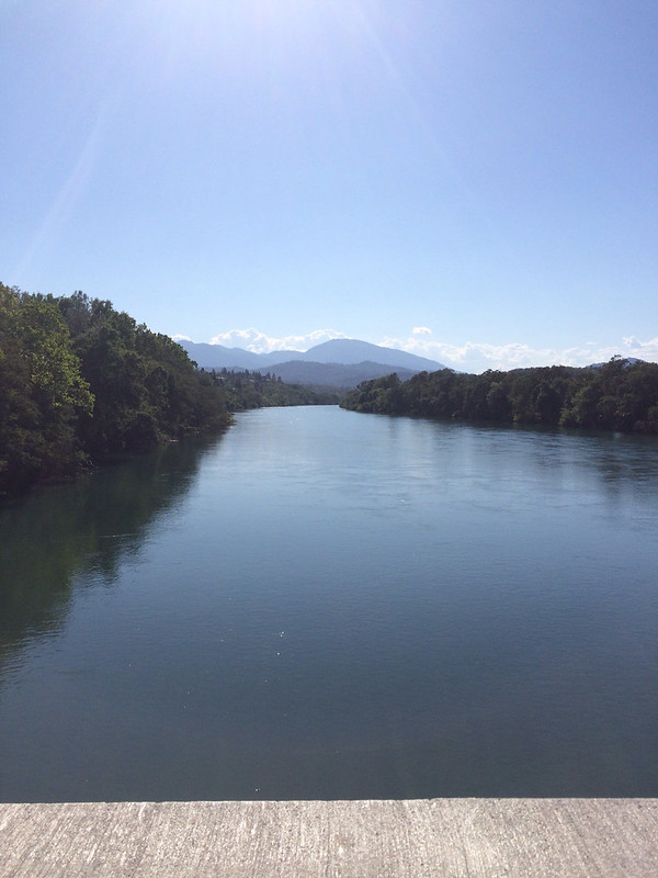
Redding has a great system of paved bike trails, along with a Rail Trail. All the trails were accessible from the unique Sundial Bridge - one of three dedicated bike/pedestrian bridges over the Sacremento River. The map showed that we could ride across the Sundial Bridge, the up the river to the Stress Ribbon Bridge, up to a dam and then back on the other side of the river.
The first part of the ride was nice, in the shade with the breeze created from riding, the heat wasn't so bad. Then it opened out into typical California yellow brown scrub. And, the trail got hiller. It was hot. Soon we came to the Stress Ribbon Bridge and right after it, our turnaround point, the dam.
At the dam there was a big hill, and Dad wanted to ride up it. Turns out this is where the Rail Trail began! I decided it was too hot and didn't want to ride up it, but told him to go ahead, so he did and I rode back! He only rose to the top of the big hill and came back down, but he didn't catch me until I was back at the Sundial Bridge.
It was a good bike ride, nice to ride on pavement, even if it was hot! I'm a bit bummed I never made it to the actual Rail Trail, but the Sacremento River Trail was good enough!
No comments:
Post a Comment